IMAGES TAKEN NEAR TO
Oldfield Avenue, EASTBOURNE, BN20 9PX
Introduction
This page details the photographs taken nearby to Oldfield Avenue, BN20 9PX by members of the Geograph project.
The Geograph project started in 2005 with the aim of publishing, organising and preserving representative images for every square kilometre of Great Britain, Ireland and the Isle of Man.

There are currently over 7.5m images from over14,400 individuals and you can help contribute to the project by visiting https://www.geograph.org.uk
Image Map
Images are licensed for reuse under creativecommons.org/licenses/by-sa/2.0
Notes
- Clicking on the map will re-center to the selected point.
- The higher the marker number, the further away the image location is from the centre of the postcode.
Image Listing (13 Images Found)
Images are licensed for reuse under creativecommons.org/licenses/by-sa/2.0
Image
Details
Distance
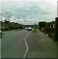
2
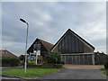
St Wilfrid, Lower Willingdon: early December 2015
Image: © Basher Eyre
Taken: 7 Dec 2015
0.15 miles
3
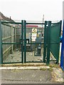
Electricity sub station, Rapson's Road
Image: © Alex McGregor
Taken: 10 Feb 2015
0.17 miles
4

Willingdon Community School taken from the Downs
The 3 school buses are waiting to collect the students, some of whom are going to miss them because they are still on the Downs finishing the annual sponsored walk!
Image: © Dave Creighton
Taken: 25 Sep 2008
0.18 miles
7
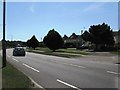
The A2270 Eastbourne Road south through Willingdon
Image: © Dave Spicer
Taken: 20 Aug 2013
0.22 miles
8
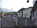
Shops on The Triangle, Willingdon
Looking towards the South Downs which surround much of Eastbourne
Image: © David Howard
Taken: 3 Apr 2016
0.23 miles
9
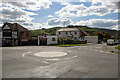
The British Queen, Lower Willingdon, East Sussex
Positioned in The Triangle, Lower Willingdon, the British Queen pub draws much of its clientele from the local area. This photo also shows part of Wannock Lane with the South Downs and Coombe Hill in the distance.
Image: © Andrew Diack
Taken: 18 Sep 2022
0.24 miles