IMAGES TAKEN NEAR TO
Badgers Brow, EASTBOURNE, BN20 9EE
Introduction
This page details the photographs taken nearby to Badgers Brow, BN20 9EE by members of the Geograph project.
The Geograph project started in 2005 with the aim of publishing, organising and preserving representative images for every square kilometre of Great Britain, Ireland and the Isle of Man.

There are currently over 7.5m images from over14,400 individuals and you can help contribute to the project by visiting https://www.geograph.org.uk
Image Map
Images are licensed for reuse under creativecommons.org/licenses/by-sa/2.0
Notes
- Clicking on the map will re-center to the selected point.
- The higher the marker number, the further away the image location is from the centre of the postcode.
Image Listing (41 Images Found)
Images are licensed for reuse under creativecommons.org/licenses/by-sa/2.0
Image
Details
Distance
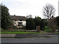
1
"Wedderburn Rd 472534" sub-station
So labelled, but although close to the end of the indicated road, it is actually on the narrow strip between Wish Hill and Upper Wish Hill.
Image: © Robin Webster
Taken: 28 May 2010
0.07 miles
2
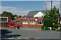
Home of the Beachy Head chaplaincy team
So says the small sign, but not very close to Beachy Head - does it make a difference?
Image: © Robin Webster
Taken: 28 May 2010
0.09 miles
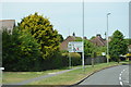
3
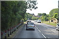
Babylon Way turns off Parkway
Babylon Way gets its name from Babylon Down, the wooded slope in the distance. The roads in this area have easy but steep access up through the woods to the top of the downs.
Image: © Robin Webster
Taken: 28 May 2010
0.12 miles
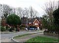
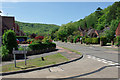
5
Denescroft, Upper Kings Drive
Thatched house on the road that links Willingdon village with Willingdon Roundabout.
Image: © Simon Carey
Taken: 24 Jan 2009
0.13 miles
6
![Following the Jubilee Way in Eastbourne [7]](https://s2.geograph.org.uk/geophotos/07/19/45/7194510_218daafd_120x120.jpg)
Following the Jubilee Way in Eastbourne [7]
From an area that has been cleared of diseased trees, Eastbourne and the coast is seen over the rooftops of the houses of Old Mansion Close.
The Jubilee Way runs along the 300-foot contour of the wooded slopes of the South Downs escarpment overlooking Eastbourne. Some 6 miles long, the path runs from Willingdon through meadows and woodland to Eastbourne seafront. The path was named the Jubilee Way in 1977 in celebration of the Queen’s Silver Jubilee. Ash dieback disease has decimated the area.
Image: © Michael Dibb
Taken: 2 May 2022
0.13 miles
7
![Willingdon houses [16]](https://s3.geograph.org.uk/geophotos/07/19/81/7198167_a8b2a8b8_120x120.jpg)
Willingdon houses [16]
Odd numbers 91 to 97 Wish Hill are a terrace of 4 houses. Probably built in the mid 19th century. Constructed of knapped flint with brick quoins and dressings under a hipped tile roof. Listed, grade II, with details at: https://historicengland.org.uk/listing/the-list/list-entry/1190664
Once isolated villages, Upper Willingdon and Lower Willingdon, are now part of the built-up area of Eastbourne. Set on a spur at the foot of the South Downs, the village lies astride the A22 road, about 1 mile south of Polegate. There is evidence of occupation since the pre-Saxon age.
Image: © Michael Dibb
Taken: 10 May 2022
0.15 miles
9
![Willingdon houses [15]](https://s0.geograph.org.uk/geophotos/07/19/81/7198164_17171202_120x120.jpg)
Willingdon houses [15]
Stream Cottage, number 65 Wish Hill, was probably built in the early to mid 19th century. Constructed of cobbles with brick quoins and dressings, partly rendered and painted, all under a tile roof. Listed, grade II, with details at: https://historicengland.org.uk/listing/the-list/list-entry/1043658
Once isolated villages, Upper Willingdon and Lower Willingdon, are now part of the built-up area of Eastbourne. Set on a spur at the foot of the South Downs, the village lies astride the A22 road, about 1 mile south of Polegate. There is evidence of occupation since the pre-Saxon age.
Image: © Michael Dibb
Taken: 10 May 2022
0.17 miles