IMAGES TAKEN NEAR TO
The Court, Hoo Gardens, EASTBOURNE, BN20 9AX
Introduction
This page details the photographs taken nearby to The Court, Hoo Gardens, BN20 9AX by members of the Geograph project.
The Geograph project started in 2005 with the aim of publishing, organising and preserving representative images for every square kilometre of Great Britain, Ireland and the Isle of Man.

There are currently over 7.5m images from over14,400 individuals and you can help contribute to the project by visiting https://www.geograph.org.uk
Image Map
Images are licensed for reuse under creativecommons.org/licenses/by-sa/2.0
Notes
- Clicking on the map will re-center to the selected point.
- The higher the marker number, the further away the image location is from the centre of the postcode.
Image Listing (160 Images Found)
Images are licensed for reuse under creativecommons.org/licenses/by-sa/2.0
Image
Details
Distance
1
![Willingdon houses [7]](https://s1.geograph.org.uk/geophotos/07/19/71/7197177_81546c50_120x120.jpg)
Willingdon houses [7]
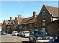
The Hoo, Church Street, is a very large house designed by Sir Edwin Lutyens for Alexander Wedderburn in 1902, and is regarded as one of Lutyens finest houses. The main front faces south, away from the street, and is now converted into 11 flats. There is a central range and two projecting wings. Constructed of painted brick with red brick dressings and quoins, all under tile roofs. There are other images at Image and at Image Listed, grade I, with details at: https://historicengland.org.uk/listing/the-list/list-entry/1184911
Once isolated villages, Upper Willingdon and Lower Willingdon, are now part of the built-up area of Eastbourne. Set on a spur at the foot of the South Downs, the village lies astride the A22 road, about 1 mile south of Polegate. There is evidence of occupation since the pre-Saxon age.
Image: © Michael Dibb
Taken: 10 May 2022
0.04 miles
2
![Willingdon houses [8]](https://s2.geograph.org.uk/geophotos/07/19/71/7197178_2adfecb4_120x120.jpg)
Willingdon houses [8]
The Hoo, Church Street, is a very large house designed by Sir Edwin Lutyens for Alexander Wedderburn in 1902, and is regarded as one of Lutyens finest houses. The main front faces south, away from the street, and is now converted into 11 flats. There is a central range and two projecting wings. Constructed of painted brick with red brick dressings and quoins, all under tile roofs. There are other images at Image and at Image Listed, grade I, with details at: https://historicengland.org.uk/listing/the-list/list-entry/1184911
Once isolated villages, Upper Willingdon and Lower Willingdon, are now part of the built-up area of Eastbourne. Set on a spur at the foot of the South Downs, the village lies astride the A22 road, about 1 mile south of Polegate. There is evidence of occupation since the pre-Saxon age.
Image: © Michael Dibb
Taken: 10 May 2022
0.05 miles
3
![Willingdon houses [9]](https://s0.geograph.org.uk/geophotos/07/19/71/7197180_2d5bddf2_120x120.jpg)
Willingdon houses [9]
The Hoo, Church Street, is a very large house designed by Sir Edwin Lutyens for Alexander Wedderburn in 1902, and is regarded as one of Lutyens finest houses. The main front faces south, away from the street, and is now converted into 11 flats. There is a central range and two projecting wings. Constructed of painted brick with red brick dressings and quoins, all under tile roofs. There are other images at Image and at Image Listed, grade I, with details at: https://historicengland.org.uk/listing/the-list/list-entry/1184911
Once isolated villages, Upper Willingdon and Lower Willingdon, are now part of the built-up area of Eastbourne. Set on a spur at the foot of the South Downs, the village lies astride the A22 road, about 1 mile south of Polegate. There is evidence of occupation since the pre-Saxon age.
Image: © Michael Dibb
Taken: 10 May 2022
0.05 miles
4
![Willingdon houses [6]](https://s0.geograph.org.uk/geophotos/07/19/71/7197172_84285472_120x120.jpg)
Willingdon houses [6]
Numbers 28 and 30 Church Street are dated 1758. Constructed of cobbles under a tile roof. Listed, grade II, with details at: https://historicengland.org.uk/listing/the-list/list-entry/1028503
Once isolated villages, Upper Willingdon and Lower Willingdon, are now part of the built-up area of Eastbourne. Set on a spur at the foot of the South Downs, the village lies astride the A22 road, about 1 mile south of Polegate. There is evidence of occupation since the pre-Saxon age.
Image: © Michael Dibb
Taken: 10 May 2022
0.05 miles
5
Almshouses, Willingdon
The almshouses were designed by Edward Lutyens.
Image: © nick macneill
Taken: 6 May 2013
0.05 miles
6
![Willingdon houses [11]](https://s0.geograph.org.uk/geophotos/07/19/71/7197184_90fef34a_120x120.jpg)
Willingdon houses [11]
St Wilfred's, number 22 Church Street, has an 18th century front on an older building. The left bay has been added. Constructed of stuccoed brick under a
tile roof. Listed, grade II, with details at: https://historicengland.org.uk/listing/the-list/list-entry/1028502
Once isolated villages, Upper Willingdon and Lower Willingdon, are now part of the built-up area of Eastbourne. Set on a spur at the foot of the South Downs, the village lies astride the A22 road, about 1 mile south of Polegate. There is evidence of occupation since the pre-Saxon age.
Image: © Michael Dibb
Taken: 10 May 2022
0.06 miles
7
![Willingdon houses [5]](https://s1.geograph.org.uk/geophotos/07/19/71/7197169_351245c0_120x120.jpg)
Willingdon houses [5]
Even numbers 32 to 38 Church Street are a row of four cottages of almshouse character. Dated 1857 and constructed of coursed flints with dressings of cement under tile roofs. There is a shaped and a plain gable. Listed, grade II, with details at: https://historicengland.org.uk/listing/the-list/list-entry/1028504
Once isolated villages, Upper Willingdon and Lower Willingdon, are now part of the built-up area of Eastbourne. Set on a spur at the foot of the South Downs, the village lies astride the A22 road, about 1 mile south of Polegate. There is evidence of occupation since the pre-Saxon age.
Image: © Michael Dibb
Taken: 2 May 2022
0.06 miles
8
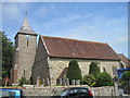
Flag at half-mast for Her Majesty Queen Elizabeth II, Eastbourne
The photo shows the Union Jack flying at half-mast at St Mary's, Willingdon in respect of the passing of Her Majesty Queen Elizabeth II.
Image: © Andrew Diack
Taken: 18 Sep 2022
0.06 miles
9
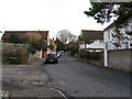
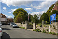
Church Street
The main village street of Willingdon a settlement swallowed up by Eastbourne during the 20th century. The building to the right is Flint House.
Image: © Simon Carey
Taken: 24 Jan 2009
0.07 miles