
IMAGES TAKEN NEAR TO
Warren Lane, EASTBOURNE, BN20 0HD
Introduction
This page details the photographs taken nearby to Warren Lane, BN20 0HD by members of the Geograph project.
The Geograph project started in 2005 with the aim of publishing, organising and preserving representative images for every square kilometre of Great Britain, Ireland and the Isle of Man.

There are currently over 7.5m images from over14,400 individuals and you can help contribute to the project by visiting https://www.geograph.org.uk
Image Map
Images are licensed for reuse under creativecommons.org/licenses/by-sa/2.0
Notes
- Clicking on the map will re-center to the selected point.
- The higher the marker number, the further away the image location is from the centre of the postcode.
Image Listing (316 Images Found)
Images are licensed for reuse under creativecommons.org/licenses/by-sa/2.0
Image
Details
Distance
1
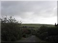
Hillside, East Dean
A residential road part of the Downlands estate that was originally laid out in the late 1920s and developed intermittently up to the Second World War and completed after. The road heads east from Warren Lane then turns north and follows the slope down to Deneside. The hill beyond is Mill Down.
Image: © Simon Carey
Taken: 30 Nov 2013
0.05 miles
2
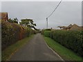
Warren Lane, East Dean
Viewed from the southern end of the lane that heads northwards along the eastern brow of the hill and joins The Ridgeway at the junction with The Brow. The road was laid out in the late 1920s and developed intermittently before the Second World War. Beyond the hedge on the right is the junction with Image whilst further up to the left is another with Windmill Lane.
Image: © Simon Carey
Taken: 30 Nov 2013
0.06 miles
8
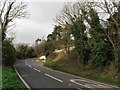
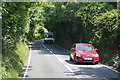
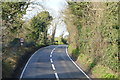
Friston Hill, East Dean
The name of the A259 between the junction with Upper Street in East Dean and Jevington Road in Friston. The bend and small section to the left beyond form the old parish boundary between the two villages before it heads northwards.
Image: © Simon Carey
Taken: 30 Nov 2013
0.10 miles
9

Linden Mead
A substantial flint and brick mansion, adjacent to Hobbs Eares, and with views over East Dean village and the downs.
Image: © David M Clark
Taken: 25 Jul 2026
0.10 miles
10

Hobb's Eares
Meadow on the outskirts of East Dean.
Image: © Ian Capper
Taken: 10 Jul 2025
0.11 miles