IMAGES TAKEN NEAR TO
The Ridgeway, EASTBOURNE, BN20 0EZ
Introduction
This page details the photographs taken nearby to The Ridgeway, BN20 0EZ by members of the Geograph project.
The Geograph project started in 2005 with the aim of publishing, organising and preserving representative images for every square kilometre of Great Britain, Ireland and the Isle of Man.

There are currently over 7.5m images from over14,400 individuals and you can help contribute to the project by visiting https://www.geograph.org.uk
Image Map
Images are licensed for reuse under creativecommons.org/licenses/by-sa/2.0
Notes
- Clicking on the map will re-center to the selected point.
- The higher the marker number, the further away the image location is from the centre of the postcode.
Image Listing (185 Images Found)
Images are licensed for reuse under creativecommons.org/licenses/by-sa/2.0
Image
Details
Distance
1
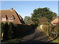
Royston Close, Friston
A small cul de sac that lies off The Ridgeway that was built sometime during the 1970s on the site of former tennis courts.
Image: © Simon Carey
Taken: 16 Nov 2013
0.04 miles
2
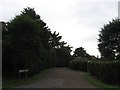
Friston Close, East Dean
A small cul de sac off Windmill Lane laid out in the late 1920s but not developed until after the war. The close lies in part of an old field called Standard Island according to East Dean's 1844 tithe map which was part of another field over the parish boundary called Friston Field, according to Friston's 1848 tithe map. However, the 1876 OS map marks the field as Standard Island though it disappears from all maps thereafter.
Image: © Simon Carey
Taken: 30 Nov 2013
0.07 miles
3
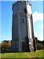
Old Water Tower, Friston
Taken from Willingdon Road looking South East.
Image: © Simon Carey
Taken: 4 Mar 2006
0.09 miles
4
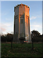
Friston Water Tower
Viewed from Old Willingdon Road, the tower was built during the 1930s.
Image: © Simon Carey
Taken: 23 Nov 2013
0.10 miles
5
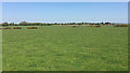
A glimpse of Friston water tower from near the Crowlink car park
The tower is in a residential area on the west side of Friston. None of those extensive estates can be seen: they're hidden by trees. The light-coloured wall across the picture is some 250m from the A259 that runs along the south side of the village.
Image: © Robin Stott
Taken: 6 May 2018
0.10 miles
6
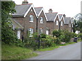
Row of Victorian cottages at Friston
Adjacent to the Water Tower Image
Image: © Jonathan Billinger
Taken: 28 Jun 2007
0.10 miles
7
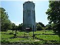
Water tower and masts on Old Willingdon Road
Image: © Dave Spicer
Taken: 19 Jul 2012
0.10 miles
8
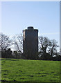
Friston Water Tower
Viewed from a bridleway that links Old Willingdon Road to Jevington Road. The tower dates from the late Victorian period.
Image: © Simon Carey
Taken: 16 Nov 2013
0.10 miles
9
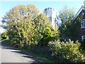
Friston Water Tower
Friston Water Tower is next to Old Willingdon Road which eventually becomes a bridleway and heads up on to the South Downs at Willingdon Hill. There are some very exclusive houses on the right along here, just past the water tower.
Image: © Marathon
Taken: 21 Oct 2018
0.10 miles