IMAGES TAKEN NEAR TO
Jevington Road, EASTBOURNE, BN20 0AG

Introduction

This page details the photographs taken nearby to Jevington Road, BN20 0AG by members of the Geograph project.

The Geograph project started in 2005 with the aim of publishing, organising and preserving representative images for every square kilometre of Great Britain, Ireland and the Isle of Man.

There are currently over 7.5m images from over14,400 individuals and you can help contribute to the project by visiting https://www.geograph.org.uk

Image Map


Images are licensed for reuse under creativecommons.org/licenses/by-sa/2.0
Notes
  • Clicking on the map will re-center to the selected point.
  • The higher the marker number, the further away the image location is from the centre of the postcode.

Image Listing (180 Images Found)

Images are licensed for reuse under creativecommons.org/licenses/by-sa/2.0
  • ...
Image
Details
Distance
1
Modern House, Friston
Designed to look over the forested Friston Bottom. Taken from the footpath that links Friston with Friston Forest.
Image: © Simon Carey Taken: 25 Nov 2007
0.03 miles
2
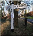
Road Junction, Friston
Jevington Road to the left heads north to Jevington and Polegate, Old Willingdon Road to the right heads northwards to Field House where it ends, though a bridleway follows the old road onwards to Willingdon via Willingdon Hill and Butts lane. The house in view on the former is called Hillsborough. Both routes are very old highways.
Image: © Simon Carey Taken: 23 Nov 2013
0.06 miles
3
Willingdon Rd
Image: © N Chadwick Taken: 3 Jun 2020
0.06 miles
4
Old Direction Sign - Signpost by Old Willingdon Road, Friston
Black iron cap finial - 2 arms; East Sussex wood by the UC road, in parish of East Dean and Friston (Wealden District), Y-junction of Wannock Road with Old Willingdon Road, on verge. Surveyed Milestone Society National ID: SX_TV5598B
Image: © Milestone Society Taken: Unknown
0.06 miles
5
Old Willingdon Road junction at Friston
Image: © Dave Spicer Taken: 19 Jul 2012
0.07 miles
6
Waterworks Cottages, Old Willingdon Road, Friston
Built in the late Victorian period for the workers employed at Friston Pumping Station in the valley below. The six cottages were the first buildings on the road and predate Image which lies just beyond them.
Image: © Simon Carey Taken: 23 Nov 2013
0.07 miles
7
Waterworks Cottages
Image: © N Chadwick Taken: 3 Jun 2020
0.07 miles
8
Tunnel Entrance, The Warren
The tunnel as marked on the map runs from this point behind Image and ends on Warren Lane in Eastdean just over the old parish boundary with Friston. From what I can gather I think this is a service tunnel for a much larger pipeline that was built in 1897 to connect a borehole in Friston, now site of Image, to the Meads area of Eastbourne.
Image: © Simon Carey Taken: 16 Nov 2013
0.08 miles
9
Row of Victorian cottages at Friston
Adjacent to the Water Tower Image
Image: © Jonathan Billinger Taken: 28 Jun 2007
0.08 miles
10
Covered Reservoir, The Warren
Built in 1897 and lying adjacent to Jevington Road on the edge of Friston Forest.
Image: © Simon Carey Taken: 16 Nov 2013
0.08 miles
  • ...