
IMAGES TAKEN NEAR TO
Science Park Road, BRIGHTON, BN1 9RS
Introduction
This page details the photographs taken nearby to Science Park Road, BN1 9RS by members of the Geograph project.
The Geograph project started in 2005 with the aim of publishing, organising and preserving representative images for every square kilometre of Great Britain, Ireland and the Isle of Man.

There are currently over 7.5m images from over14,400 individuals and you can help contribute to the project by visiting https://www.geograph.org.uk
Image Map
Images are licensed for reuse under creativecommons.org/licenses/by-sa/2.0
Notes
- Clicking on the map will re-center to the selected point.
- The higher the marker number, the further away the image location is from the centre of the postcode.
Image Listing (217 Images Found)
Images are licensed for reuse under creativecommons.org/licenses/by-sa/2.0
Image
Details
Distance
1

Multitude of Signs, University of Sussex
As I was taking this picture a car pulled up spent about a minute scanning the signs before asking me where the Medical School was. On the junction of Southern Ring Road and Science Park Road.
Image: © Simon Carey
Taken: 18 Feb 2008
0.02 miles
2
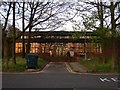
Thermo Fluid Mechanics Research Centre, University of Sussex
Located at the eastern end of Science Car Park with the windows reflecting the light from the setting sun.
Image: © Simon Carey
Taken: 13 Apr 2014
0.03 miles
3
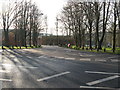
Southern Ring Road University of Sussex
Image: © Dave Spicer
Taken: 18 Dec 2012
0.03 miles
4
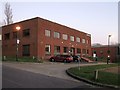
Ashdown House, University of Sussex
On the eastern side of the campus to the immediate north of Innovation Centre. Not sure which faculty uses this building.
Image: © Simon Carey
Taken: 16 Mar 2014
0.04 miles
5
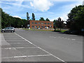
Ashdown House, University of Sussex
One of the newer blocks on the eastern edge of the campus viewed from Science car park. It is home to the Regional Development Office.
Image: © Simon Carey
Taken: 7 Jun 2009
0.04 miles

7

Freeman Centre, University of Sussex
Home to the Social Policy Research Unit and located on the Southern Ring Road on the eastern side of the campus near the village of Falmer.
Image: © Simon Carey
Taken: 16 Mar 2014
0.05 miles
8
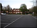
Trafford Centre, University of Sussex
Located at the north eastern end of the Science Car Park and home to research facilities for the Brighton & Sussex Medical School.
Image: © Simon Carey
Taken: 13 Apr 2014
0.05 miles
9
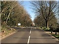
Eastern Ring Road, University of Sussex
Originally one way, southbound only, but now takes traffic in both directions after the opening of a second access road to the west. The road on the left is Pavilion Road which leads to the campus sports centre.
Image: © Simon Carey
Taken: 16 Mar 2014
0.06 miles
10
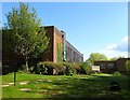
John Clifford West, University of Sussex
Located on the eastern side of the campus and home to the engineering department.
Image: © Simon Carey
Taken: 19 Apr 2014
0.06 miles