
IMAGES TAKEN NEAR TO
Kenwards, BRIGHTON, BN1 9EN
Introduction
This page details the photographs taken nearby to Kenwards, BN1 9EN by members of the Geograph project.
The Geograph project started in 2005 with the aim of publishing, organising and preserving representative images for every square kilometre of Great Britain, Ireland and the Isle of Man.

There are currently over 7.5m images from over14,400 individuals and you can help contribute to the project by visiting https://www.geograph.org.uk
Image Map
Images are licensed for reuse under creativecommons.org/licenses/by-sa/2.0
Notes
- Clicking on the map will re-center to the selected point.
- The higher the marker number, the further away the image location is from the centre of the postcode.
Image Listing (29 Images Found)
Images are licensed for reuse under creativecommons.org/licenses/by-sa/2.0
Image
Details
Distance
1
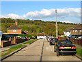
Haig Avenue, Coldean
Residential road running between Hawkhurst road and Beatty Avenue, Stanmer Great Wood provides the backdrop and is located beyond the A27 which is hidden in a cutting.
Image: © Simon Carey
Taken: 19 Apr 2014
0.08 miles
2
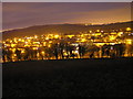
Coldean from nearby Field
taken at 10:30pm using a large F number and long exposure time.
Image: © David
Taken: 11 Dec 2005
0.12 miles
3
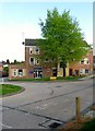
Coldean Library, Beatty Avenue, Coldean
Located at the junction with Selham Drive and opened in 1975.
Image: © Simon Carey
Taken: 19 Apr 2014
0.13 miles
5
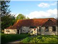
St Mary Magdalen, Coldean
The local church is in fact a converted flint barn that once belonged to Coldean Farm that was later known as The Menagerie that was demolished to make way for Image The barn dates back to 1780 and for many centuries was the only building on the western side of Coldean Lane. It was converted to its current use in 1955.
Image: © Simon Carey
Taken: 19 Apr 2014
0.14 miles
6
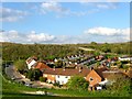
Coldean
The northern part of the suburb built in a former dry valley called Cold Dean. Much of the estate dates from the post war period which this section occupying a former field called Pattis Wye according to Stanmer's 1840 tithe map. Pattis Wye is an alternative name to Patchway, the detached portion of Falmer parish that lay to the immediate west, see Image, that was transferred to Stanmer in 1934. The road in the foreground is Saunders Hill whilst in the distance is the bridge that takes the A27 Brighton Bypass over Coldean Lane.
Image: © Simon Carey
Taken: 19 Apr 2014
0.15 miles
7
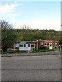
Coldean Youth Club, Beatty Avenue, Coldean
Lying to the immediate west of Image is the hut containing the youth club on the right and its neighbour, KC Contracts and a heating and plumbing firm.
Image: © Simon Carey
Taken: 19 Apr 2014
0.15 miles
8
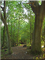
Footpath to Coldean
Protected by a belt of trees and linking Great Wood to Coldean Lane via a footbridge over the A27.
Image: © Simon Carey
Taken: 21 Sep 2011
0.15 miles
9
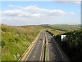
Brighton Bypass
The A27 looking eastwards from Image with Stanmer Great Wood to the left and Falmer Hill in the distance. The road was opened in the 1990s and provides the northern boundary of the city effectively providing a dividing line for where development and expansion can and cannot take place.
Image: © Simon Carey
Taken: 19 Apr 2014
0.16 miles
10
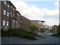
Varley Park, University of Brighton
The original set of halls were built during the 1970s and were added to during the 1990s. In the last five years there has been a further expansion of blocks.
Image: © Simon Carey
Taken: 19 Apr 2014
0.17 miles