IMAGES TAKEN NEAR TO
Northfield Lane, BRIGHTON, BN1 9BJ
Introduction
This page details the photographs taken nearby to Northfield Lane, BN1 9BJ by members of the Geograph project.
The Geograph project started in 2005 with the aim of publishing, organising and preserving representative images for every square kilometre of Great Britain, Ireland and the Isle of Man.

There are currently over 7.5m images from over14,400 individuals and you can help contribute to the project by visiting https://www.geograph.org.uk
Image Map
Images are licensed for reuse under creativecommons.org/licenses/by-sa/2.0
Notes
- Clicking on the map will re-center to the selected point.
- The higher the marker number, the further away the image location is from the centre of the postcode.
Image Listing (70 Images Found)
Images are licensed for reuse under creativecommons.org/licenses/by-sa/2.0
Image
Details
Distance
1

Northfield, University of Sussex
New halls of residence being constructed at the northern end of the campus. Building work has gradually been creeping northwards for the past decade or so and will most likely be filled in the future as the bottom of the valley does not fall within the South Downs national park boundary though the slopes do. Beyond is The Ridge.
Image: © Simon Carey
Taken: 18 Dec 2010
0.03 miles
2

Northfield, University of Sussex
These students residences were opened a couple of years ago and are now the northern end of the campus. See Image for a view before the construction of the buildings.
Image: © Simon Carey
Taken: 16 Mar 2014
0.04 miles
3

Lewes Court, University of Sussex
Taken from the car park at the northern end of the campus. The closeness of the Downs can be seen in the gap to the left.
Image: © Simon Carey
Taken: 18 Mar 2008
0.06 miles
4

Northern Edge of University of Sussex Campus
Taken from the edge of a belt of woodland that provides the border for Brighton and Lewes District Councils. The university was built in the early 1960s on land that was formerly part of Stanmer Park which had been in the ownership of Brighton Council since the end of World War Two. The fields around the campus edge belong to St Mary's Farm but have open access for campus users.
Image: © Simon Carey
Taken: 18 Mar 2008
0.06 miles
5

Lewes Court, University of Sussex
Viewed from the steps to Brighthelm and looking across the car park to the halls of residence on the northern end of the campus.
Image: © Simon Carey
Taken: 18 Mar 2008
0.07 miles
6

University of Sussex
Buildings at the University of Sussex viewed across the grid from Moon’s Corner.
Image: © Chris Thomas-Atkin
Taken: 1 Apr 2021
0.07 miles
7

Northern Edge of University of Sussex Campus
Looking down from near the observatory on Richmond Hill and following the boundary of the university's campus made up by Lewes Court. On the far side is the ridge lined by Sunny Bank Wood.
Image: © Simon Carey
Taken: 18 Mar 2008
0.08 miles
8

Lewes Court, University of Sussex
Rear view of the northern edge of the campus. Beyond the hill is Stanmer Park part of which was originally donated for the university to build on.
Image: © Simon Carey
Taken: 18 Feb 2008
0.08 miles
9

Oak near the University of Sussex
Taken in a field belonging to St Mary's Farm which also contains the university boundary trail and looking southwards towards the northern edge of the campus, the halls of residence known as Lewes Court.
Image: © Simon Carey
Taken: 18 Mar 2008
0.08 miles
10
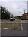
Car Park, Lewes Court, University of Sussex
Most northerly of the campus car parks, mainly serving the halls of residence in the vicinity. A lone rabbit feeds on the grass in the holes of the parking surface.
Image: © Simon Carey
Taken: 18 Mar 2008
0.10 miles