
IMAGES TAKEN NEAR TO
Standean, BRIGHTON, BN1 8ZA
Introduction
This page details the photographs taken nearby to Standean, BN1 8ZA by members of the Geograph project.
The Geograph project started in 2005 with the aim of publishing, organising and preserving representative images for every square kilometre of Great Britain, Ireland and the Isle of Man.

There are currently over 7.5m images from over14,400 individuals and you can help contribute to the project by visiting https://www.geograph.org.uk
Image Map
Images are licensed for reuse under creativecommons.org/licenses/by-sa/2.0
Notes
- Clicking on the map will re-center to the selected point.
- The higher the marker number, the further away the image location is from the centre of the postcode.
Image Listing (14 Images Found)
Images are licensed for reuse under creativecommons.org/licenses/by-sa/2.0
Image
Details
Distance
1

Standean Cottages
Semi-detached cottages on the lane to Standean that were built after World War Two.
Image: © Simon Carey
Taken: 25 Apr 2020
0.02 miles
2

Alpha and Beta Cottages by bridleway to Patcham
The sheep running down the distant hillside were catching up on the ones that had found a small gap between a gate and gate post, resulting in a made dash for the wheat field on the right.
Image: © Dave Spicer
Taken: 20 Feb 2011
0.06 miles

4
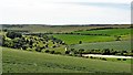
View WSW from a point south of New Barn
The track on the left heads up to Lower Standean - which lies to the right of the photo.
Image: © Ian Hawfinch
Taken: 15 Jun 2020
0.13 miles
5
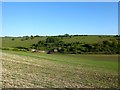
Donkey Bottom
With Tegdown Hill beyond.
Image: © Simon Carey
Taken: 25 Apr 2020
0.15 miles
6
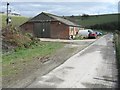
Ditchling, shed
The road is a bridleway leading to Lower Standean farm
Image: © Peter Cox
Taken: 17 Mar 2008
0.16 miles
7
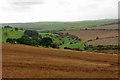
Ewe Bottom
The road to Lower Standean Farm winds its way up the bottom, the track to Middown House branches off this and curves round the spur on the right.
Image: © Robin Webster
Taken: 13 Sep 2010
0.19 miles
8

View from the eastern side of Ewe Bottom Hill
The road up the valley leads to Alpha Cottage and Beta Cottage,which are visible, then onto Lower Standean
Image: © Dave Spicer
Taken: 6 Mar 2010
0.20 miles
9

Poor Brow
Located to the north east of Deep Bottom.
Image: © Simon Carey
Taken: 25 Apr 2020
0.21 miles
10

Cattle, Tegdown Hill - aerial view
Viewed from hot air balloon G-CDRN, which had launched from Patcham Place recreation ground, heading about NE at first.
Image: © Robin Webster
Taken: 27 Jun 2015
0.23 miles