
IMAGES TAKEN NEAR TO
Highview Avenue North, BRIGHTON, BN1 8WR
Introduction
This page details the photographs taken nearby to Highview Avenue North, BN1 8WR by members of the Geograph project.
The Geograph project started in 2005 with the aim of publishing, organising and preserving representative images for every square kilometre of Great Britain, Ireland and the Isle of Man.

There are currently over 7.5m images from over14,400 individuals and you can help contribute to the project by visiting https://www.geograph.org.uk
Image Map
Images are licensed for reuse under creativecommons.org/licenses/by-sa/2.0
Notes
- Clicking on the map will re-center to the selected point.
- The higher the marker number, the further away the image location is from the centre of the postcode.
Image Listing (120 Images Found)
Images are licensed for reuse under creativecommons.org/licenses/by-sa/2.0
Image
Details
Distance
1
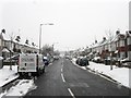
Vale Avenue, Patcham
Built in the 1930s as the main access route from London Road to the new estates to the east of the old village of Patcham.
Image: © Simon Carey
Taken: 20 Jan 2013
0.07 miles
5
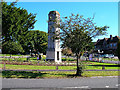
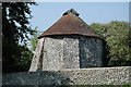
Clock Tower, Ladies Mile, Patcham
Built in the 1930s to advertise the newly built Ladies Mile estate. Looking north east Mackie Avenue leads off to the right whilst the road in the foreground Vale Avenue twists north then west to the northern end of the old village of Patcham and the A23/A27 interchange.
Image: © Simon Carey
Taken: 18 Sep 2005
0.11 miles
6

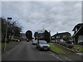
Patcham Clock Tower
Another view of the clock tower on the Ladies Mile estate first submitted by Simon Image, it's good to report that the clock was telling the correct time. The Ladies Mile estate was developed by George Ferguson in the 1930s.
Image: © Nigel Cox
Taken: 8 Jun 2008
0.11 miles
7

Church Hill, Patcham
Street in front of All Saints Church http://www.mybrightonandhove.org.uk/page_id__5538_path__0p115p210p550p.aspx
Image: © Paul Gillett
Taken: 9 Jan 2011
0.12 miles
8
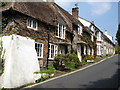
Flint cottages in Church Hill, Patcham (2)
Image: © Brian Slater
Taken: 21 Apr 2009
0.12 miles
9
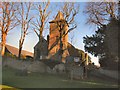
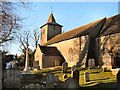
All Saints Church, Patcham
View from Church Hill
A place of worship has existed on the hilltop site for about 1000 years, but the present building has Norman internal features and a 13th-century exterior. Several rounds of restoration in the Victorian era included some structural additions. A wide range of monuments and wall paintings survive inside, including one commemorating Richard Shelley—owner of nearby Patcham Place and one of the most important noblemen in the early history of Brighton. The church, which has been listed at Grade II* by English Heritage for its architectural and historical importance http://en.wikipedia.org/wiki/All_Saints_Church,_Patcham
Image: © Paul Gillett
Taken: 9 Jan 2011
0.12 miles
10
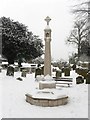
Patcham War Memorial
Standing in the graveyard of Image
Image: © Simon Carey
Taken: 20 Jan 2013
0.12 miles