
IMAGES TAKEN NEAR TO
Buttercup Walk, BRIGHTON, BN1 8PN
Introduction
This page details the photographs taken nearby to Buttercup Walk, BN1 8PN by members of the Geograph project.
The Geograph project started in 2005 with the aim of publishing, organising and preserving representative images for every square kilometre of Great Britain, Ireland and the Isle of Man.

There are currently over 7.5m images from over14,400 individuals and you can help contribute to the project by visiting https://www.geograph.org.uk
Image Map
Images are licensed for reuse under creativecommons.org/licenses/by-sa/2.0
Notes
- Clicking on the map will re-center to the selected point.
- The higher the marker number, the further away the image location is from the centre of the postcode.
Image Listing (27 Images Found)
Images are licensed for reuse under creativecommons.org/licenses/by-sa/2.0
Image
Details
Distance
1
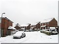
Old Boat Walk, Hollingbury
Small cul de sac off Carden Avenue built in the last twenty years or so. The road is named after the local nickname for the nearby junction of Ditchling Road and Coldean Lane where an old upturned boat used to serve as a shepherds hut.
Image: © Simon Carey
Taken: 20 Jan 2013
0.02 miles
2

Petworth Road, Hollingbury
Small estate of Carden Avenue built in the late 1930s.
Image: © Simon Carey
Taken: 20 Jan 2013
0.05 miles
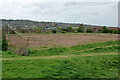
4
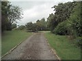
Carden Park
Carden Park is situated south of the industrial estate in Hollingbury
Image: © Paul Gillett
Taken: 15 Jul 2009
0.09 miles
5
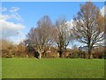
Carden Park, Hollingbury
The park covers 12 acres near to the Industrial estate
Image: © Paul Gillett
Taken: 19 Dec 2014
0.09 miles
6
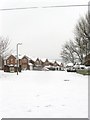
Windmill View, Patcham
A recently constructed small estate built on the site of Patcham Fawcett secondary school for boys which occupied this spot from 1965 until it amalgamated with the nearby girl school in 1989 and formed Patcham High School.
Image: © Simon Carey
Taken: 20 Jan 2013
0.09 miles
7
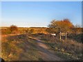
Ladies Mile Footpath
Leading from Ladies Mile Road eastwards, The path that appeared clearly on the map was not that evident at this time in January probably due to recent rain
Image: © Paul Gillett
Taken: 9 Jan 2011
0.10 miles
8
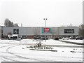
Retail Units, Hollingbury Industrial Estate
Marks & Spencer, Argos and Next occupy units on Carden Avenue. On a normal day this shot would be obscured by a number of parked cars though on this day the persistant snow has kept many away.
Image: © Simon Carey
Taken: 20 Jan 2013
0.10 miles
9
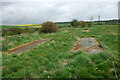
Four concrete bases, Ladies Mile
These are associated with the playing fields of the school that was once here. Probably cricket nets, they would be covered with matting.
Image: © Robin Webster
Taken: 30 Apr 2010
0.12 miles
10
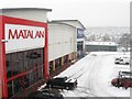
Retail Units, Hollingbury Industrial Estate
Brantano and Matalan occupy these units located on the corner of Crowhurst Road and Carden Avenue. Beyond are more, see Image
Image: © Simon Carey
Taken: 20 Jan 2013
0.12 miles