
IMAGES TAKEN NEAR TO
Elsted Crescent, BRIGHTON, BN1 8GE
Introduction
This page details the photographs taken nearby to Elsted Crescent, BN1 8GE by members of the Geograph project.
The Geograph project started in 2005 with the aim of publishing, organising and preserving representative images for every square kilometre of Great Britain, Ireland and the Isle of Man.

There are currently over 7.5m images from over14,400 individuals and you can help contribute to the project by visiting https://www.geograph.org.uk
Image Map
Images are licensed for reuse under creativecommons.org/licenses/by-sa/2.0
Notes
- Clicking on the map will re-center to the selected point.
- The higher the marker number, the further away the image location is from the centre of the postcode.
Image Listing (28 Images Found)
Images are licensed for reuse under creativecommons.org/licenses/by-sa/2.0
Image
Details
Distance
1
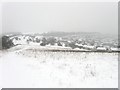
Open Access Land, Hollingbury
A large swathe of downland between Ditchling Road and the built up estates of Hollingbury are now open access. The large amount of snow falling is reducing visibility somewhat.
Image: © Simon Carey
Taken: 20 Jan 2013
0.04 miles

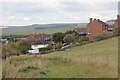
4
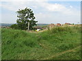
Short footpath linking Ditchling Road with housing Elsted Crescent
Image: © Dave Spicer
Taken: 12 Aug 2012
0.07 miles
5
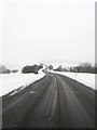
Ditchling Road
One of the longest and highest roads in the Brighton & Hove area stretching from St Peter's Church to Ditchling Beacon. The road was turnpiked in 1770 and for a while was part of the main London-Brighton route. This section is heading north to Old Boat Corner, the junction of the road with Coldean Lane and Carden Avenue.
Image: © Simon Carey
Taken: 20 Jan 2013
0.07 miles
6
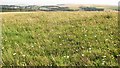
Downland meadow in Brighton Wild Park
Looking north towards Hollingbury and the Downs beyond, this gives some impression of what much downland might have been like before extensive ploughing and improvement.
Image: © Patrick Roper
Taken: 6 Aug 2009
0.11 miles
7
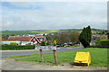
View from end of Ditchling Crescent
One of the higher points of the northern Brighton suburbs.
Image: © Robin Webster
Taken: 30 Apr 2010
0.11 miles
8
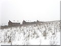
Stanmer Heights
A small estate lying on the high northern fringes of Brighton's conurbation. The flats are located in Bramble Way.
Image: © Simon Carey
Taken: 20 Jan 2013
0.13 miles
9
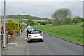
Ditchling Crescent, Hollingbury, Brighton
Image: © Robin Webster
Taken: 30 Apr 2010
0.13 miles
10
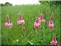
Sainfoin flowers at Wildpark
Hollingbury Wildpark LNR has many species of wild flower, Sainfoin being one of the prettiest, found in Spring on either side of the Ditchling Road.
Image: © Peter Whitcomb
Taken: 3 Jun 2005
0.14 miles