IMAGES TAKEN NEAR TO
Coombe Lane, ARUNDEL, BN18 9RL
Introduction
This page details the photographs taken nearby to Coombe Lane, BN18 9RL by members of the Geograph project.
The Geograph project started in 2005 with the aim of publishing, organising and preserving representative images for every square kilometre of Great Britain, Ireland and the Isle of Man.

There are currently over 7.5m images from over14,400 individuals and you can help contribute to the project by visiting https://www.geograph.org.uk
Image Map
Images are licensed for reuse under creativecommons.org/licenses/by-sa/2.0
Notes
- Clicking on the map will re-center to the selected point.
- The higher the marker number, the further away the image location is from the centre of the postcode.
Image Listing (23 Images Found)
Images are licensed for reuse under creativecommons.org/licenses/by-sa/2.0
Image
Details
Distance
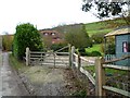
2
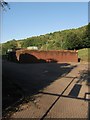
Coombe Cottage
Located on Coombe Lane,I have a feeling the original cottage may have been built with neighbouring Image
Image: © Simon Carey
Taken: 3 Aug 2013
0.01 miles
3
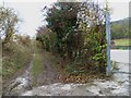
Combe Lane from Perry Hill
The trees hide a pumping station to the right and a house to the left. Only the garden is visible.
Image: © Robin Webster
Taken: 30 May 2010
0.02 miles
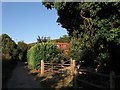
5
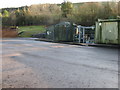
Coombe Lane passes pumping station
At this point the lane, which has bridleway status, becomes unsurfaced.
Image: © Shazz
Taken: 6 Dec 2011
0.03 miles
6
Burpham Pumping Station
The current pumping station dates from 1975 though that was built to replace an older one from 1938. A filtration plant was added in 1991. The station is located in Coombe Lane.
Image: © Simon Carey
Taken: 3 Aug 2013
0.04 miles
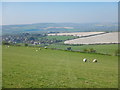
8
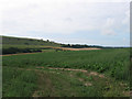
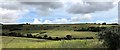
Third Townsend Field/Second Townsend Field
The name of the field according to Burpham's 1840 tithe maps that have been extended to make a larger unit. Third Townsend Field was in the foreground whilst Second Townsend Field lay further to the south and bounded Image The trees to the left mark the location of Image whilst beyond is the southern end of Perry Hill.
Image: © Simon Carey
Taken: 14 Aug 2013
0.13 miles
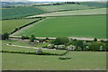
9
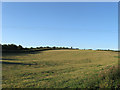
Townsend Field
The name of the field according to Burpham's 1840 tithe map that is bounded by Image to the south west, Image to the north west and Image to the south.
Image: © Simon Carey
Taken: 3 Aug 2013
0.15 miles