
IMAGES TAKEN NEAR TO
Dover Lane, ARUNDEL, BN18 9PX
Introduction
This page details the photographs taken nearby to Dover Lane, BN18 9PX by members of the Geograph project.
The Geograph project started in 2005 with the aim of publishing, organising and preserving representative images for every square kilometre of Great Britain, Ireland and the Isle of Man.

There are currently over 7.5m images from over14,400 individuals and you can help contribute to the project by visiting https://www.geograph.org.uk
Image Map
Images are licensed for reuse under creativecommons.org/licenses/by-sa/2.0
Notes
- Clicking on the map will re-center to the selected point.
- The higher the marker number, the further away the image location is from the centre of the postcode.
Image Listing (39 Images Found)
Images are licensed for reuse under creativecommons.org/licenses/by-sa/2.0
Image
Details
Distance
1
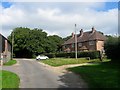
310-311, Dover Lane
Estate cottages built in the 1950s on the eastern side of the lane.
Image: © Simon Carey
Taken: 17 Sep 2017
0.01 miles
2
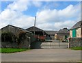
Outbuildings, Priorslease Farm, Dover Lane
All that remains of the farm, the former farmhouse was located to the south and was demolished possibly after World War Two.
Image: © Simon Carey
Taken: 17 Sep 2017
0.03 miles
3
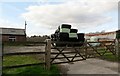
Farmyard, Priorsleas Farm near Poling
Image: © nick macneill
Taken: 15 Feb 2013
0.03 miles
4
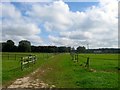
Angmering Park
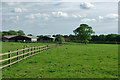
The name of the field according to Angmering's 1839 tithe map that is located on the eastern side of Dover Lane to the south of Butlers Copse. Colt Bungalow is the building visible in the distance.
Image: © Simon Carey
Taken: 17 Sep 2017
0.05 miles
6
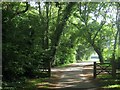
Dover Lane
The point where public vehicular access ends with the entrance to Image on the left. Once through the gate the lane becomes bridleway 2192.
Image: © Simon Carey
Taken: 28 Aug 2017
0.08 miles
7
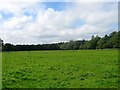
Barn Field
The name of the field according to Angmering's 1839 tithe map that is bounded by Dover Lane to its north and east as well as Image to the south.
Image: © Simon Carey
Taken: 17 Sep 2017
0.08 miles
8
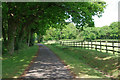
Lane towards end of Dover Lane
Access to The Dover House.
Image: © Robin Webster
Taken: 30 May 2010
0.13 miles
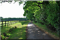
10
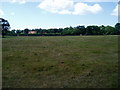
Footpath to A27
Public footpath 2192/1 crosses field with stile in distance. The roof of Chestnut Tree House can be seen amongst the trees. It is the only children's hospice in Sussex caring for young people with life-limiting and life threatening illnesses.
Image: © Peter Holmes
Taken: 17 Jul 2010
0.14 miles