
IMAGES TAKEN NEAR TO
South Stoke, ARUNDEL, BN18 9PE
Introduction
This page details the photographs taken nearby to BN18 9PE by members of the Geograph project.
The Geograph project started in 2005 with the aim of publishing, organising and preserving representative images for every square kilometre of Great Britain, Ireland and the Isle of Man.

There are currently over 7.5m images from over14,400 individuals and you can help contribute to the project by visiting https://www.geograph.org.uk
Image Map
Images are licensed for reuse under creativecommons.org/licenses/by-sa/2.0
Notes
- Clicking on the map will re-center to the selected point.
- The higher the marker number, the further away the image location is from the centre of the postcode.
Image Listing (6 Images Found)
Images are licensed for reuse under creativecommons.org/licenses/by-sa/2.0
Image
Details
Distance
1

View south towards Arundel Park from the S bank of the R Arun
Image: © Ian Hawfinch
Taken: 18 Apr 2021
0.05 miles
2

Woodland east of Dry Lodge Plantation
This is in the access land on the east side of Arundel Park.
Image: © Ian Hawfinch
Taken: 16 Aug 2022
0.12 miles
4

Arundel Park trig point
Standing in one of the highest parts of Arundel Park, the trig point is 106m above sea level.
Image: © Mark Percy
Taken: 3 Dec 2016
0.19 miles
5
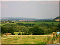
View of the Arun cutting its way through the South Downs
The picture has been taken from the point where the lane to South Stoke meets the farm track from Blue Doors. The view itself has the Arun below it hidden by the line trees as it sweeps from West to East. The buildings to the left are North Stoke, a line to the right is the railway that runs from Three Bridges to Ford whilst hidden from view straight ahead is Houghton Bridge.
Image: © Simon Carey
Taken: 18 Aug 2005
0.22 miles
6
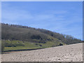
Newly ploughed field, South Stoke
A flock of birds rises from a newly ploughed field. The very light colour of the soil shows how chalky the land is.
Image: © Stephen Craven
Taken: 6 Apr 2007
0.25 miles