IMAGES TAKEN NEAR TO
Binsted, ARUNDEL, BN18 0LN

Introduction

This page details the photographs taken nearby to BN18 0LN by members of the Geograph project.

The Geograph project started in 2005 with the aim of publishing, organising and preserving representative images for every square kilometre of Great Britain, Ireland and the Isle of Man.

There are currently over 7.5m images from over14,400 individuals and you can help contribute to the project by visiting https://www.geograph.org.uk

Image Map


Images are licensed for reuse under creativecommons.org/licenses/by-sa/2.0
Notes
  • Clicking on the map will re-center to the selected point.
  • The higher the marker number, the further away the image location is from the centre of the postcode.

Image Listing (73 Images Found)

Images are licensed for reuse under creativecommons.org/licenses/by-sa/2.0
  • ...
Image
Details
Distance
1
Church Farm Bungalows
Just the two chimneys remain of the former dwellings on Binsted Lane.
Image: © Simon Carey Taken: 24 Oct 2010
0.04 miles
2
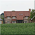
House on the east side of Binsted Lane
Image: © Ian Hawfinch Taken: 2 Jun 2021
0.04 miles
3
Mount Pleasant
The name of two cottages on Binsted Lane. The houses in the distance are in Walberton.
Image: © Simon Carey Taken: 24 Oct 2010
0.04 miles
4
Avisford Park Golf Course
Occupying the small valley formed by Binsted Brook. The hole in view here was once, according to the 1838 tithe map, a field called Little Canny Moor.
Image: © Simon Carey Taken: 10 Oct 2010
0.06 miles
5
Barns, Church Farm
To the south of the farmhouse is a collection of barns of varying ages and style. These are located next to a bend in Binsted Lane.
Image: © Simon Carey Taken: 10 Oct 2010
0.07 miles
6
Church Mead
The name of the field according to the 1838 tithe map. Part of the field that slopes down to Binsted Brook is now a green on Avisford Park golf course. St Mary's church lies at the end of the field.
Image: © Simon Carey Taken: 10 Oct 2010
0.09 miles
7
The Fourteen Acres
The name of the field according to the 1838 tithe map that has been extended to include Church Croft which lay at the far eastern end, as well as Image and Image to the north. The woods in the distance are North Lees Copse to the left and Spinningwheel Copse to the right.
Image: © Simon Carey Taken: 10 Oct 2010
0.09 miles
8
Lane running north from St Mary's, Binsted
Image: © Basher Eyre Taken: 27 Feb 2010
0.11 miles
9
Farmland west of St Mary's, Binsted
Image: © Basher Eyre Taken: 27 Feb 2010
0.11 miles
10
Molehills in the churchyard at St Mary's, Binsted
Image: © Basher Eyre Taken: 27 Feb 2010
0.12 miles
  • ...