IMAGES TAKEN NEAR TO
Ford Lane, ARUNDEL, BN18 0DF
Introduction
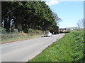
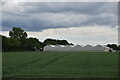
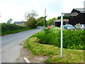
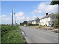
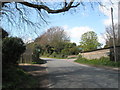
This page details the photographs taken nearby to Ford Lane, BN18 0DF by members of the Geograph project.
The Geograph project started in 2005 with the aim of publishing, organising and preserving representative images for every square kilometre of Great Britain, Ireland and the Isle of Man.

There are currently over 7.5m images from over14,400 individuals and you can help contribute to the project by visiting https://www.geograph.org.uk
Image Map
Images are licensed for reuse under creativecommons.org/licenses/by-sa/2.0
Notes
- Clicking on the map will re-center to the selected point.
- The higher the marker number, the further away the image location is from the centre of the postcode.
Image Listing (37 Images Found)
Images are licensed for reuse under creativecommons.org/licenses/by-sa/2.0
Image
Details
Distance
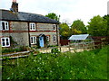
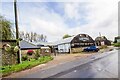
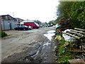
6
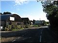
Wicks Farm
Outbuildings from the farm that have been put to new use, furniture restorers and a recording studio are two of them. Beyond on Ford Lane is one of the entrances to Ford Lane Business Park.
Image: © Simon Carey
Taken: 24 Oct 2010
0.09 miles