IMAGES TAKEN NEAR TO
Chichester Road, ARUNDEL, BN18 0AG
Introduction
This page details the photographs taken nearby to Chichester Road, BN18 0AG by members of the Geograph project.
The Geograph project started in 2005 with the aim of publishing, organising and preserving representative images for every square kilometre of Great Britain, Ireland and the Isle of Man.

There are currently over 7.5m images from over14,400 individuals and you can help contribute to the project by visiting https://www.geograph.org.uk
Image Map
Images are licensed for reuse under creativecommons.org/licenses/by-sa/2.0
Notes
- Clicking on the map will re-center to the selected point.
- The higher the marker number, the further away the image location is from the centre of the postcode.
Image Listing (19 Images Found)
Images are licensed for reuse under creativecommons.org/licenses/by-sa/2.0
Image
Details
Distance
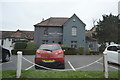
3
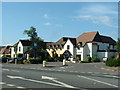
White Swan Hotel
A27 landmark near entry to Arundel in the SW of this square.
Image: © Chris Shaw
Taken: Unknown
0.05 miles
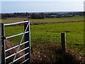
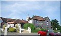
5
Track to Park Farm
Public footpath 346.
Image: © Peter Holmes
Taken: 15 Jun 2013
0.12 miles
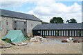
6
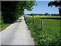
Public footpath 348
Path follows road to Park Farm.
Image: © Peter Holmes
Taken: 22 May 2010
0.13 miles
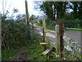
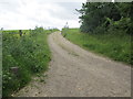
7
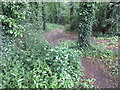
Path to Park Bottom
Public Footpath 3070.
Image: © Peter Holmes
Taken: 15 Jun 2013
0.14 miles
8
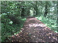
Track to Park Bottom Farm
Public footpath 3060.
Image: © Peter Holmes
Taken: 15 Jun 2013
0.15 miles