IMAGES TAKEN NEAR TO
Chichester Road, ARUNDEL, BN18 0AB
Introduction
This page details the photographs taken nearby to Chichester Road, BN18 0AB by members of the Geograph project.
The Geograph project started in 2005 with the aim of publishing, organising and preserving representative images for every square kilometre of Great Britain, Ireland and the Isle of Man.

There are currently over 7.5m images from over14,400 individuals and you can help contribute to the project by visiting https://www.geograph.org.uk
Image Map
Images are licensed for reuse under creativecommons.org/licenses/by-sa/2.0
Notes
- Clicking on the map will re-center to the selected point.
- The higher the marker number, the further away the image location is from the centre of the postcode.
Image Listing (112 Images Found)
Images are licensed for reuse under creativecommons.org/licenses/by-sa/2.0
Image
Details
Distance
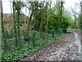
1
The bridleway reaches the Arundel & District Community Hospital (2)
Image: © Shazz
Taken: 4 Jan 2013
0.00 miles
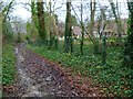
2
The bridleway reaches the Arundel & District Community Hospital (1)
Just look at the mud!
Image: © Shazz
Taken: 4 Jan 2013
0.03 miles
3
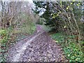
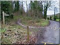
Another squelchy path
This wet weather has made all the bridleways and footpaths very heavy going. This was a tiring ascent from the big roundabout at Arundel. I will tick the "sport, leisure" box anyway.
Image: © Shazz
Taken: 4 Jan 2013
0.03 miles
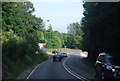
4
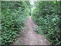
Track to The Waterwoods
Public bridleway 415.
Image: © Peter Holmes
Taken: 15 Jun 2013
0.12 miles
5
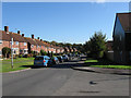
Canada Road
Suburban street linking Jarvis Road to Torton Hill Road. The houses were built in the 1950s on the site of former allotments that had existed during the interwar period. The road itself was once a field access route called Green Lane. Taken from the junction with Ellis Close.
Image: © Simon Carey
Taken: 24 Oct 2010
0.14 miles
6
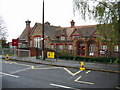
St Philips catholic primary school, London Road
Image: © Nick Smith
Taken: 24 Oct 2008
0.15 miles
7
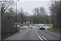
Torton Hill Road
Viewed from the small triangle land that forms the junction of Torton Hill Road with Canada Road. The latter was once an access track called Green Lane whilst the trees to the left are the remnants of a former wood called Rookswood. Some pipe/cable laying seems to be imminent.
Image: © Simon Carey
Taken: 24 Oct 2010
0.15 miles
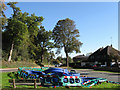
10
Signpost at bridleway and restricted byway junction at Arundel
Image: © Shazz
Taken: 4 Jan 2013
0.16 miles