
IMAGES TAKEN NEAR TO
Barnett Road, BRIGHTON, BN1 7GH
Introduction
This page details the photographs taken nearby to Barnett Road, BN1 7GH by members of the Geograph project.
The Geograph project started in 2005 with the aim of publishing, organising and preserving representative images for every square kilometre of Great Britain, Ireland and the Isle of Man.

There are currently over 7.5m images from over14,400 individuals and you can help contribute to the project by visiting https://www.geograph.org.uk
Image Map
Images are licensed for reuse under creativecommons.org/licenses/by-sa/2.0
Notes
- Clicking on the map will re-center to the selected point.
- The higher the marker number, the further away the image location is from the centre of the postcode.
Image Listing (25 Images Found)
Images are licensed for reuse under creativecommons.org/licenses/by-sa/2.0
Image
Details
Distance
2
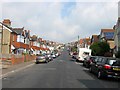
Hollingdean Terrace, Hollingdean, Brighton
The road actually runs between Roedale Road to the south and Hollingbury Rise to the north and was developed in the early 1900s. The section in view here is located to the north of the crossroads with Hollingbury Crescent and Hollingbury Place. See also Image
Image: © Simon Carey
Taken: 4 Oct 2015
0.12 miles

4
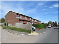
Lynchet Close, Hollingdean, Brighton
Houses on Lynchet Close in Hollingdean, a suburb of Brighton.
Image: © Malc McDonald
Taken: 24 Aug 2019
0.14 miles
5
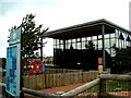
Hollingdean Children's Centre
Hollingdean Children's Centre (HCC) offers services for families with children under 5 years to all areas of Hollingdean, Preston Park/Preston area, Hollingbury and Patcham, Withdene, Westdene and Tongdene. Cherry Tree Nursery is based in the Children's Centre.
http://www.brighton-hove.gov.uk/index.cfm?request=c1191457
Image: © Paul Gillett
Taken: 15 Jul 2009
0.14 miles
6
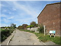
Driveway near Brighton
A driveway leading to a small car park on the outskirts of Brighton. The wooden signpost indicates the route of a public footpath.
Image: © Malc McDonald
Taken: 24 Aug 2019
0.15 miles
7
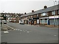
Shops in Hollingbury Place
On the Hollingdean estate
Image: © Paul Gillett
Taken: 20 Feb 2011
0.15 miles
8
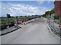
Road works
Road leading to car park for Hollingdean allotment gardens. Also designated footpath to Hollingbury Castle.
Image: © Peter Holmes
Taken: 9 Jun 2011
0.15 miles
9
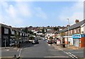
Hollingdean Place, Hollingdean, Brighton
Located on the floor of what was once Cowley's Bottom which prior to 1900 consisted of just Harrington Farm which was located behind the shops to the right. The parade of shops either side has the usual selection of local convenience stores, wine merchants and takeaways. Hertford Road is on the right in the foreground and Roedale Road to the left.
Image: © Simon Carey
Taken: 4 Oct 2015
0.16 miles
10
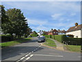
The Crestway, Hollingdean, Brighton
The Crestway is a residential road on a steep hill in Hollingbury, a suburb of Brighton.
Image: © Malc McDonald
Taken: 24 Aug 2019
0.16 miles