
IMAGES TAKEN NEAR TO
Petunia Grove, BN17 7TS
Introduction
This page details the photographs taken nearby to Petunia Grove, BN17 7TS by members of the Geograph project.
The Geograph project started in 2005 with the aim of publishing, organising and preserving representative images for every square kilometre of Great Britain, Ireland and the Isle of Man.

There are currently over 7.5m images from over14,400 individuals and you can help contribute to the project by visiting https://www.geograph.org.uk
Image Map
Images are licensed for reuse under creativecommons.org/licenses/by-sa/2.0
Notes
- Clicking on the map will re-center to the selected point.
- The higher the marker number, the further away the image location is from the centre of the postcode.
Image Listing (8 Images Found)
Images are licensed for reuse under creativecommons.org/licenses/by-sa/2.0
Image
Details
Distance
2
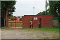
Wick F.C. turnstiles
Adults £5.00, children and OAPs £2.50. Welcome to Crabtree Park!
Image: © Robin Webster
Taken: 2 Jul 2010
0.14 miles
3
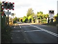
Toddington: Toddington Lane level crossing
It's a long way to the stations in either direction from this level crossing on the busy West Coastway railway line so trains pass by at speeds up to 70mph.
Image: © Nigel Cox
Taken: 17 Sep 2009
0.14 miles
4

Worthing Road Allotments, Littlehampton
Image: © Robin Webster
Taken: 2 Jul 2010
0.15 miles
5
Toddington level crossing
A suburb of Littlehampton that is predominately nurseries.
Image: © Dave Spicer
Taken: 29 Sep 2012
0.15 miles
6

Worthing Road Allotments, Littlehampton
Image: © Robin Webster
Taken: 2 Jul 2010
0.17 miles

8
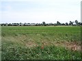
Glasshouses of Toddington
Part of Holyacre Farm according to the OS map. These are best seen from the railway line that passes closer. Taken from the bridleway between Lyminster and Poling
Image: © Bob Embleton
Taken: 21 Jun 2006
0.22 miles