IMAGES TAKEN NEAR TO
Condor Mews, LITTLEHAMPTON, BN17 7RE
Introduction
This page details the photographs taken nearby to Condor Mews, BN17 7RE by members of the Geograph project.
The Geograph project started in 2005 with the aim of publishing, organising and preserving representative images for every square kilometre of Great Britain, Ireland and the Isle of Man.

There are currently over 7.5m images from over14,400 individuals and you can help contribute to the project by visiting https://www.geograph.org.uk
Image Map
Images are licensed for reuse under creativecommons.org/licenses/by-sa/2.0
Notes
- Clicking on the map will re-center to the selected point.
- The higher the marker number, the further away the image location is from the centre of the postcode.
Image Listing (18 Images Found)
Images are licensed for reuse under creativecommons.org/licenses/by-sa/2.0
Image
Details
Distance
1
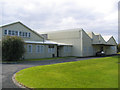
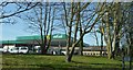
Industrial estate buildings, Wick
Offices & warehouses of a book distributor. Quite nice to see a bit of grass in an industrial estate.
Image: © Slbs
Taken: Unknown
0.05 miles
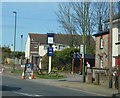
2
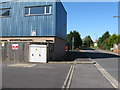
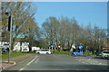
Courtwick Lane Wick
Industrial units to the south and residential on the right.
Image: © Dave Spicer
Taken: 29 Sep 2012
0.07 miles
10
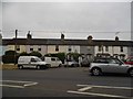
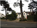
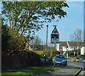
Terrace of houses on Lyminster Road, Wick
Image: © David Howard
Taken: 23 Jun 2018
0.17 miles