IMAGES TAKEN NEAR TO
Stanford Acre, LITTLEHAMPTON, BN17 7FN
Introduction
This page details the photographs taken nearby to Stanford Acre, BN17 7FN by members of the Geograph project.
The Geograph project started in 2005 with the aim of publishing, organising and preserving representative images for every square kilometre of Great Britain, Ireland and the Isle of Man.

There are currently over 7.5m images from over14,400 individuals and you can help contribute to the project by visiting https://www.geograph.org.uk
Image Map
Images are licensed for reuse under creativecommons.org/licenses/by-sa/2.0
Notes
- Clicking on the map will re-center to the selected point.
- The higher the marker number, the further away the image location is from the centre of the postcode.
Image Listing (11 Images Found)
Images are licensed for reuse under creativecommons.org/licenses/by-sa/2.0
Image
Details
Distance
5
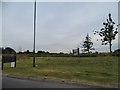
Fields by Benjamin Grey Drive, Littlehampton
Image: © David Howard
Taken: 23 Jun 2018
0.16 miles
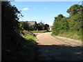
6
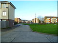
Flats and play area by the west end of Clun Road
Image: © Shazz
Taken: 9 Dec 2015
0.17 miles
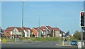
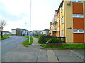
7
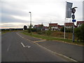
Benjamin Grey Drive, Littlehampton
A new estate.
Image: © David Howard
Taken: 23 Jun 2018
0.17 miles
9
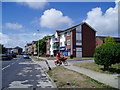
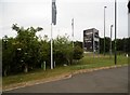
Postie in Clun Road
At junction with Kimberry. Block of flats called Houghton House with Mace store on ground floor.
Image: © Peter Holmes
Taken: 22 Jul 2010
0.18 miles
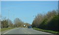
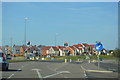
10
Looking west along the front of Boxgrove House
Image: © Shazz
Taken: 9 Dec 2015
0.19 miles