IMAGES TAKEN NEAR TO
Nimbus Close, LITTLEHAMPTON, BN17 6RX
Introduction
This page details the photographs taken nearby to Nimbus Close, BN17 6RX by members of the Geograph project.
The Geograph project started in 2005 with the aim of publishing, organising and preserving representative images for every square kilometre of Great Britain, Ireland and the Isle of Man.

There are currently over 7.5m images from over14,400 individuals and you can help contribute to the project by visiting https://www.geograph.org.uk
Image Map
Images are licensed for reuse under creativecommons.org/licenses/by-sa/2.0
Notes
- Clicking on the map will re-center to the selected point.
- The higher the marker number, the further away the image location is from the centre of the postcode.
Image Listing (17 Images Found)
Images are licensed for reuse under creativecommons.org/licenses/by-sa/2.0
Image
Details
Distance
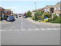
3
Fastnet Way from the junction with Admirals Walk
Image: © Shazz
Taken: 29 May 2016
0.13 miles
4
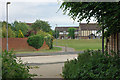
Footpath crossing at Timberleys
The footpath starts at Horsham Road, and takes a straight course until here, when an erratic route is threaded through this area of fairly new development.
Image: © Robin Webster
Taken: 2 Jul 2010
0.14 miles
5
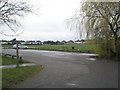
Littlehampton to Rustington and back (122)
Carpark for the rec in Southfields Road.
Image: © Basher Eyre
Taken: 18 Mar 2011
0.16 miles
7
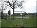
Littlehampton to Rustington and back (124)
Playpark in Southfields Road.
Image: © Basher Eyre
Taken: 18 Mar 2011
0.17 miles
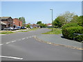
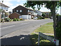
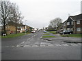
8
Littlehampton to Rustington and back (119)
Mid section of Southfields Road.
Image: © Basher Eyre
Taken: 18 Mar 2011
0.17 miles
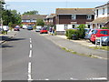
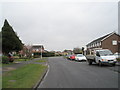
9
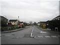
Littlehampton to Rustington and back (118)
Looking from Southfields Road into Fastnet Way.
Image: © Basher Eyre
Taken: 18 Mar 2011
0.18 miles
10
Littlehampton to Rustington and back (121)
Looking from Southfields Road into The Winter Knoll.
Image: © Basher Eyre
Taken: 18 Mar 2011
0.18 miles