IMAGES TAKEN NEAR TO
White Horses Way, LITTLEHAMPTON, BN17 6NL
Introduction
This page details the photographs taken nearby to White Horses Way, BN17 6NL by members of the Geograph project.
The Geograph project started in 2005 with the aim of publishing, organising and preserving representative images for every square kilometre of Great Britain, Ireland and the Isle of Man.

There are currently over 7.5m images from over14,400 individuals and you can help contribute to the project by visiting https://www.geograph.org.uk
Image Map (Loading...)


Getting Data...Please wait
Leaflet Map data © OpenStreetMap
Images are licensed for reuse under creativecommons.org/licenses/by-sa/2.0
Notes
- Clicking on the map will re-center to the selected point.
- The higher the marker number, the further away the image location is from the centre of the postcode.
Image Listing (69 Images Found)
Images are licensed for reuse under creativecommons.org/licenses/by-sa/2.0
Image
Details
Distance
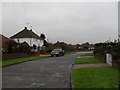
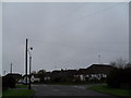
1
A range of road surfacing in The Crescent
Image: © Basher Eyre
Taken: 16 Jan 2010
0.02 miles
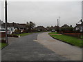
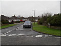
3
Looking from Tennyson Avenue towards bungalows in The Crescent
Image: © Basher Eyre
Taken: 16 Jan 2010
0.05 miles
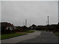
4
A murky January lunchtime in The Crescent
Image: © Basher Eyre
Taken: 16 Jan 2010
0.06 miles
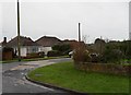
5
Looking from The Crescent into Tennyson Avenue
Image: © Basher Eyre
Taken: 16 Jan 2010
0.06 miles
6
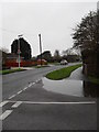
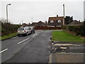
Junction of Holmes Lane and The Crescent
Image: © Basher Eyre
Taken: 16 Jan 2010
0.06 miles
7
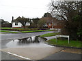
Evidence of recent heavy rain
Taken at the junction of The Crescent and Holmes Lane.
Image: © Basher Eyre
Taken: 16 Jan 2010
0.06 miles
8
Looking down Tennyson Avenue towards The Crescent
Image: © Basher Eyre
Taken: 16 Jan 2010
0.06 miles
9
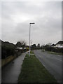
Littlehampton to Rustington and back (77)
Lampposts in Holmes Lane.
Image: © Basher Eyre
Taken: 18 Mar 2011
0.06 miles