
IMAGES TAKEN NEAR TO
Home Road, BRIGHTON, BN1 6SQ
Introduction
This page details the photographs taken nearby to Home Road, BN1 6SQ by members of the Geograph project.
The Geograph project started in 2005 with the aim of publishing, organising and preserving representative images for every square kilometre of Great Britain, Ireland and the Isle of Man.

There are currently over 7.5m images from over14,400 individuals and you can help contribute to the project by visiting https://www.geograph.org.uk
Image Map
Images are licensed for reuse under creativecommons.org/licenses/by-sa/2.0
Notes
- Clicking on the map will re-center to the selected point.
- The higher the marker number, the further away the image location is from the centre of the postcode.
Image Listing (349 Images Found)
Images are licensed for reuse under creativecommons.org/licenses/by-sa/2.0
Image
Details
Distance
1
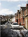
North Road, Preston
Part of the old village of Preston the road links Preston Road to Home Road.
Image: © Simon Carey
Taken: 12 Mar 2013
0.01 miles
2

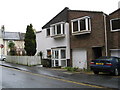
Home Road Brighton
The corner of Home Road and North Road (North Road being the one with the No Entry on the road). This was a small development built in 1971, 3 houses in Home Road, 3 in North Road and 3 in Middle Road.
The corner house shown has no rear garden.
Image: © Josie Campbell
Taken: 13 Jan 2007
0.01 miles
4
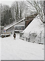
Home Road
The snow obscures the fact that road has been blocked off to prevent it becoming a little ratrun to avoid the traffic lights in the centre of Preston village. The bridge carries South Road under the London-Brighton mainline.
Image: © Simon Carey
Taken: 2 Feb 2009
0.03 miles
5
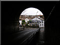
South Road, Preston
Taken from the bridge that goes under the main London-Brighton railway line. South Road (formerly Street) makes the southern boundary of the village of Preston that has long since been swallowed up by the growing conurbation of Brighton and Hove. South Street began opposite here Image] goes under the bridge then climbs Image The older ancient droveway would have extended to the Downs near Hangleton.
Image: © Simon Carey
Taken: 11 Feb 2006
0.03 miles
6
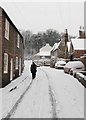
North Road
One of the old streets that formed the original Preston village which has long since been swallowed up by the expansion of Brighton.
Image: © Simon Carey
Taken: 2 Feb 2009
0.03 miles
8

Railway south of Preston Park station
The junction with the direct link from Hove is just sorting itself out on the right.
Image: © Robin Webster
Taken: 13 Apr 2019
0.03 miles
9
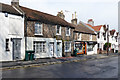
Flint buildings, South Road, Preston, Brighton
Image: © Robin Webster
Taken: 13 Apr 2019
0.04 miles
10
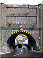
Railway bridge VTB3 181, The Drove, Brighton
Headroom 3.7 m (12'-0"), but as may be seen, a good deal more at the other end.
Image: © Robin Webster
Taken: 13 Apr 2019
0.04 miles