
IMAGES TAKEN NEAR TO
Loder Road, BRIGHTON, BN1 6PN
Introduction
This page details the photographs taken nearby to Loder Road, BN1 6PN by members of the Geograph project.
The Geograph project started in 2005 with the aim of publishing, organising and preserving representative images for every square kilometre of Great Britain, Ireland and the Isle of Man.

There are currently over 7.5m images from over14,400 individuals and you can help contribute to the project by visiting https://www.geograph.org.uk
Image Map
Images are licensed for reuse under creativecommons.org/licenses/by-sa/2.0
Notes
- Clicking on the map will re-center to the selected point.
- The higher the marker number, the further away the image location is from the centre of the postcode.
Image Listing (37 Images Found)
Images are licensed for reuse under creativecommons.org/licenses/by-sa/2.0
Image
Details
Distance
1
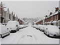
Loder Road
Linking Surrenden Road in the west with Balfour Road in the east and developed between 1900-04.
Image: © Simon Carey
Taken: 2 Feb 2009
0.03 miles
2
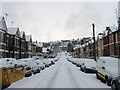
Bates Road
Residential road linking Surrenden Road with Balfour Road which can be seen in the distance.
Image: © Simon Carey
Taken: 18 Dec 2009
0.06 miles
3
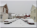
Loder Place
Small side street linking Loder Road to Bates Road.
Image: © Simon Carey
Taken: 2 Feb 2009
0.08 miles
4
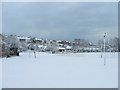
Entrance, Dorothy Stringer High School
The fence marks the spot of the school bus drop off point which then leaves the site via Loder Road to the south. Needless to say there were no buses on the road at this point, the hilly nature of Brighton makes this a regular occurrence in weather like this, and therefore no pupils at school. The houses beyond are in Balfour Road whilst the space to the left below them was the former site of Balfour Infants school which has now moved to a modern building to the east.
Image: © Simon Carey
Taken: 18 Dec 2009
0.08 miles
5
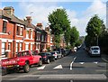
Balfour Road, Brighton
A residential road linking Preston Drove to Ditchling Road and developed between 1900 and 1904.
Image: © Simon Carey
Taken: 4 Oct 2015
0.09 miles
6
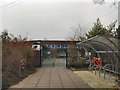
Balfour Infants School
Website: http://www.school-portal.co.uk/GroupHomepage.asp?GroupID=454772
Image: © Paul Gillett
Taken: 20 Feb 2011
0.10 miles
7

Loder Road
Opposite view of Image The junction with Loder Place is to the left.
Image: © Simon Carey
Taken: 18 Dec 2009
0.13 miles
8
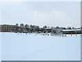
Dorothy Stringer High School
Opened in 1955 as a secondary modern and for many years lived in the shadow of the neighbouring boys and girls grammar schools. Now probably the best state school in Brighton. About 10cm of snow blanketed the city overnight causing many schools in the area to shut and allow their pupils to start their Christmas holiday a day earlier.
Image: © Simon Carey
Taken: 18 Dec 2009
0.14 miles

10

Gordon Road
Linking Surrenden Road in the west with Balfour Road in the east and developed between 1900-04.
Image: © Simon Carey
Taken: 2 Feb 2009
0.16 miles