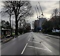
IMAGES TAKEN NEAR TO
Preston Road, BRIGHTON, BN1 6AG

Introduction

This page details the photographs taken nearby to Preston Road, BN1 6AG by members of the Geograph project.

The Geograph project started in 2005 with the aim of publishing, organising and preserving representative images for every square kilometre of Great Britain, Ireland and the Isle of Man.

There are currently over 7.5m images from over14,400 individuals and you can help contribute to the project by visiting https://www.geograph.org.uk

Image Map


Images are licensed for reuse under creativecommons.org/licenses/by-sa/2.0
Notes
  • Clicking on the map will re-center to the selected point.
  • The higher the marker number, the further away the image location is from the centre of the postcode.

Image Listing (196 Images Found)

Images are licensed for reuse under creativecommons.org/licenses/by-sa/2.0
  • ...
Image
Details
Distance
1
179, Preston Road, Brighton
The western side of Preston Road adjacent to preston Park was once lined with upmarket villas with large gardens mostly built during the 1870s, see http://regencysociety-jamesgray.com/volume18/source/jg_18_102.html. Near enough all were demolished in the 1960s and replaced by large office blocks which in turn are also starting to show their age and are being replaced by newer ones. This one is yet to be completed.
Image: © Simon Carey Taken: 4 Oct 2015
0.03 miles
2
Lovers Walk
Developed from the mid 1870s onwards though the original cottages at the A23 end have been replaced with retirement flats.
Image: © Simon Carey Taken: 27 Aug 2007
0.05 miles
3
Preston Park, Brighton
The first park owned by the council dating back to 1883 and by far the largest. In the foreground a Sunday league fixture is about to kick off whilst beyond are a block of 1960s flats known as Preston Grange. Beyond them to the left are houses located in Highcroft Villas.
Image: © Simon Carey Taken: 4 Oct 2015
0.05 miles
4
Preston Park in Brighton
Image: © Mat Fascione Taken: 29 Dec 2023
0.05 miles
5
Lovers Walk at Preston Park, Brighton
Image: © Mat Fascione Taken: 28 Jun 2024
0.05 miles
6
London-Brighton Line
Taken from Dyke Road Drive Bridge and looking as the line heads towards the disused sheds prior to the junction with the Cliftonville Spur just around the corner. To the right are the houses in Grange Close.
Image: © Simon Carey Taken: 27 Aug 2007
0.05 miles
7
Dyke Road Drive Bridge
Looking across the mainline from the maintenance area entrance in Dyke Road Drive.
Image: © Simon Carey Taken: 27 Aug 2007
0.05 miles
8
A23 Preston Road in Brighton
The cranes on the right are on the site of the former Anston House, three tower blocks containing 229 flats are being constructed.
Image: © Mat Fascione Taken: 31 Dec 2023
0.06 miles
9
Steps to Lovers Walk
Lovers Walk is a cul-de-sac that runs onto Preston Road, the A23. The steps link it with Dyke Road Drive and save the walker a mile detour.
Image: © Simon Carey Taken: 2 Feb 2009
0.06 miles
10
Bridge, Dyke Road Drive, Brighton
Looking towards the junction seen in Image The houses on the left are in Stanford Road.
Image: © Simon Carey Taken: 4 Oct 2015
0.06 miles
  • ...