IMAGES TAKEN NEAR TO
Station Road, LITTLEHAMPTON, BN16 4HY
Introduction
This page details the photographs taken nearby to Station Road, BN16 4HY by members of the Geograph project.
The Geograph project started in 2005 with the aim of publishing, organising and preserving representative images for every square kilometre of Great Britain, Ireland and the Isle of Man.

There are currently over 7.5m images from over14,400 individuals and you can help contribute to the project by visiting https://www.geograph.org.uk
Image Map
Images are licensed for reuse under creativecommons.org/licenses/by-sa/2.0
Notes
- Clicking on the map will re-center to the selected point.
- The higher the marker number, the further away the image location is from the centre of the postcode.
Image Listing (12 Images Found)
Images are licensed for reuse under creativecommons.org/licenses/by-sa/2.0
Image
Details
Distance
1
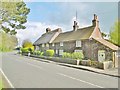
Angmering, cottages
A pair of cottages on Station Road: left (thatched roof), Old Mill House; right (tiled roof) Old Cottage. C18, Grade II listed by Historic England: https://historicengland.org.uk/listing/the-list/list-entry/1233050
Image: © Mike Faherty
Taken: 13 Apr 2019
0.03 miles
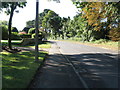
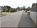
4
Angmering Baptist Church
On Station Road, replacing Image, to the North: http://www.angmeringbaptist.org.uk/all-about-us/
Image: © Mike Faherty
Taken: 13 Apr 2019
0.08 miles
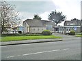
6
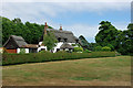
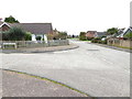
House overlooking golf course
One of several thatched houses is this select development, looking a good deal older than they really are.
Image: © Robin Webster
Taken: 2 Jul 2010
0.18 miles
7
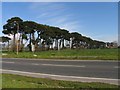
Row of Fir Trees
This row of fir trees is south of the golf club and east of the superstore and situated in the lower half and slightly into the western section of the grid square.
Image: © Pam Brophy
Taken: 16 Apr 2005
0.21 miles
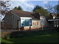
8
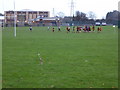
Angmering School with match in progress
For a different angle from eight years earlier see http://www.geograph.org.uk/photo/615461.
Image: © Shazz
Taken: 3 Dec 2015
0.22 miles
10

The Angmering School, Station Road
Taken from footbridge crossing A259 Roundstone By-pass Road.Webb site at :- www.angmeringschool.co.uk
Image: © Peter Holmes
Taken: 13 Nov 2007
0.24 miles