IMAGES TAKEN NEAR TO
Michel Grove, LITTLEHAMPTON, BN16 2SX
Introduction
This page details the photographs taken nearby to Michel Grove, BN16 2SX by members of the Geograph project.
The Geograph project started in 2005 with the aim of publishing, organising and preserving representative images for every square kilometre of Great Britain, Ireland and the Isle of Man.

There are currently over 7.5m images from over14,400 individuals and you can help contribute to the project by visiting https://www.geograph.org.uk
Image Map
Images are licensed for reuse under creativecommons.org/licenses/by-sa/2.0
Notes
- Clicking on the map will re-center to the selected point.
- The higher the marker number, the further away the image location is from the centre of the postcode.
Image Listing (20 Images Found)
Images are licensed for reuse under creativecommons.org/licenses/by-sa/2.0
Image
Details
Distance
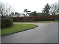
1
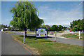
Way in, Willowhayne private estate, East Preston
Image: © Robin Webster
Taken: 2 Jul 2010
0.11 miles
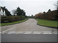
4
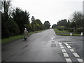
Lone pedestrian in Angmering Lane
At a point just passing Cross Road.
Image: © Basher Eyre
Taken: 16 Jan 2010
0.18 miles
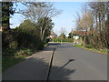
5
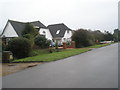
Junction of Angmering Lane and Myrtle Grove
Image: © Basher Eyre
Taken: 16 Jan 2010
0.18 miles
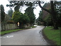
6
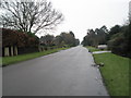
Looking from Angmering Lane into Myrtle Grove
Image: © Basher Eyre
Taken: 16 Jan 2010
0.18 miles
7
Sea Lane junction with The Street East Preston
Sea Lane maybe an appropriate name but there has been one in each of the two coastal villages to the east. There is another Sea Lane junction with another The Street in the next suburb west, Rustington.
Image: © Dave Spicer
Taken: 4 Mar 2013
0.19 miles
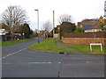
10
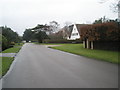
Approaching the junction of Angmering Lane and Myrtle Grove
Image: © Basher Eyre
Taken: 16 Jan 2010
0.20 miles