IMAGES TAKEN NEAR TO
Kingston Lane, LITTLEHAMPTON, BN16 1RR

Introduction

This page details the photographs taken nearby to Kingston Lane, BN16 1RR by members of the Geograph project.

The Geograph project started in 2005 with the aim of publishing, organising and preserving representative images for every square kilometre of Great Britain, Ireland and the Isle of Man.

There are currently over 7.5m images from over14,400 individuals and you can help contribute to the project by visiting https://www.geograph.org.uk

Image Map


Images are licensed for reuse under creativecommons.org/licenses/by-sa/2.0
Notes
  • Clicking on the map will re-center to the selected point.
  • The higher the marker number, the further away the image location is from the centre of the postcode.

Image Listing (67 Images Found)

Images are licensed for reuse under creativecommons.org/licenses/by-sa/2.0
  • ...
Image
Details
Distance
1
Can you do that?
Someone likes their privacy.
Image: © Fernweh Taken: 17 Apr 2016
0.04 miles
2
Kingston Lane - direction coast
Image: © Fernweh Taken: 6 Jul 2014
0.04 miles
3
Keep of the grass
Outside Kingston Manor.
Image: © Fernweh Taken: 6 Jul 2014
0.05 miles
4
Field beside Kingston Lane
Image: © Fernweh Taken: 1 Nov 2014
0.06 miles
5
Kingston Lane
Heading southwards as it passes Kingston Manor. When the latter expanded its grounds in the mid 19th century the old route south was slightly diverted to the west.
Image: © Simon Carey Taken: 13 Aug 2017
0.06 miles
6
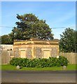
Former Lodge, Kingston Manor, Kingston Lane
Built in the 19th century at the entrance to Kingston Manor and now no longer in use being too small for residential purposes.
Image: © Simon Carey Taken: 13 Aug 2017
0.06 miles
7
Field west of Kingston Lane
Image: © Fernweh Taken: 1 Nov 2014
0.06 miles
8
Outside Kingston Manor
Image: © Fernweh Taken: 6 Jul 2014
0.08 miles
9
Fields east of Kingston Lane
Image: © Fernweh Taken: 6 Jul 2014
0.09 miles
10
Field beside Kingston Lane
Image: © Fernweh Taken: 1 Nov 2014
0.09 miles
  • ...