IMAGES TAKEN NEAR TO
The Croft, LITTLEHAMPTON, BN16 1LF
Introduction
This page details the photographs taken nearby to The Croft, BN16 1LF by members of the Geograph project.
The Geograph project started in 2005 with the aim of publishing, organising and preserving representative images for every square kilometre of Great Britain, Ireland and the Isle of Man.

There are currently over 7.5m images from over14,400 individuals and you can help contribute to the project by visiting https://www.geograph.org.uk
Image Map
Images are licensed for reuse under creativecommons.org/licenses/by-sa/2.0
Notes
- Clicking on the map will re-center to the selected point.
- The higher the marker number, the further away the image location is from the centre of the postcode.
Image Listing (49 Images Found)
Images are licensed for reuse under creativecommons.org/licenses/by-sa/2.0
Image
Details
Distance
1
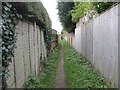
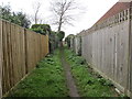
Footpath to North Lane
Public footpath 2114 from Lavinia Way.
Image: © Peter Holmes
Taken: 29 Nov 2013
0.14 miles
2
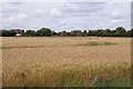
Footpath to Lavinia Way
Public Footpath 2114 from Golden Avenue.
Image: © Peter Holmes
Taken: 29 Nov 2013
0.14 miles
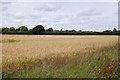
3
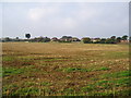
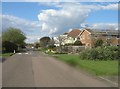
Arable land near East Preston
Looking south-west from West Kingston Farm towards East Preston.
Image: © Peter Holmes
Taken: 14 Oct 2007
0.16 miles
4
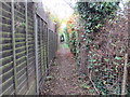
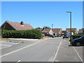
Footpath to North Lane
Public footpath 2114 from Lavinia Way.
Image: © Peter Holmes
Taken: 29 Nov 2013
0.17 miles
5
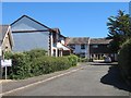
Houses in Golden Avenue
A private road close to the seaside.
Image: © Fernweh
Taken: 6 Jul 2014
0.17 miles
7
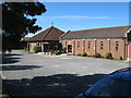
Our Lady Star of the Sea
Roman Catholic Church built in 1957 and extended in 1987
Image: © Josie Campbell
Taken: 15 Aug 2011
0.18 miles