
IMAGES TAKEN NEAR TO
Eldred Avenue, BRIGHTON, BN1 5EJ
Introduction
This page details the photographs taken nearby to Eldred Avenue, BN1 5EJ by members of the Geograph project.
The Geograph project started in 2005 with the aim of publishing, organising and preserving representative images for every square kilometre of Great Britain, Ireland and the Isle of Man.

There are currently over 7.5m images from over14,400 individuals and you can help contribute to the project by visiting https://www.geograph.org.uk
Image Map
Images are licensed for reuse under creativecommons.org/licenses/by-sa/2.0
Notes
- Clicking on the map will re-center to the selected point.
- The higher the marker number, the further away the image location is from the centre of the postcode.
Image Listing (14 Images Found)
Images are licensed for reuse under creativecommons.org/licenses/by-sa/2.0
Image
Details
Distance
2
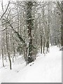
Footpath, Coney Wood
The path begins on the Patcham By Pass then climbs the hill towards Patcham Towermill.
Image: © Simon Carey
Taken: 20 Jan 2013
0.21 miles
3
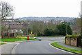
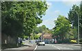
Brangwyn Crescent meets the A23
Most crescents return to the road they left, but this one does not. It changes name to Windmill Drive directly above the Patcham railway tunnel. Windmill Drive does not return either.
Image: © Robin Webster
Taken: 7 Apr 2010
0.21 miles
4
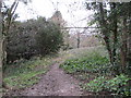
Woodland Path to Patcham-By-Pass
Public footpath FPB 86 in Coney Wood.
Image: © Peter Holmes
Taken: 18 Jan 2014
0.22 miles
5
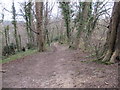
Path to Patcham-By- Pass
Public footpath FPB 86 in Coney Wood.
Image: © Peter Holmes
Taken: 18 Jan 2014
0.22 miles
6
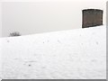
Air Shaft, Coney Hill
Marking the course of the London-Brighton railway as it travels through Patcham Tunnel. The tunnel owes its existence to the 19th century owners of Patcham Place who refused to allow the railway through their land in a cutting.
Image: © Simon Carey
Taken: 20 Jan 2013
0.22 miles
9
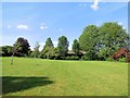
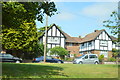
Peace Gardens, Patcham
located between London Road (A23) and the Old London Road
Image: © Paul Gillett
Taken: 29 Jun 2013
0.24 miles
10
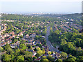
Aerial view south towards central Brighton
The A23 is the prominent road.
Image: © Robin Webster
Taken: 27 Jun 2015
0.24 miles