
IMAGES TAKEN NEAR TO
Dyke Road, BRIGHTON, BN1 5AT
Introduction
This page details the photographs taken nearby to Dyke Road, BN1 5AT by members of the Geograph project.
The Geograph project started in 2005 with the aim of publishing, organising and preserving representative images for every square kilometre of Great Britain, Ireland and the Isle of Man.

There are currently over 7.5m images from over14,400 individuals and you can help contribute to the project by visiting https://www.geograph.org.uk
Image Map
Images are licensed for reuse under creativecommons.org/licenses/by-sa/2.0
Notes
- Clicking on the map will re-center to the selected point.
- The higher the marker number, the further away the image location is from the centre of the postcode.
Image Listing (121 Images Found)
Images are licensed for reuse under creativecommons.org/licenses/by-sa/2.0
Image
Details
Distance
1
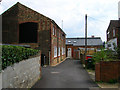
Old Mill Mews
A converted workshop behind Dyke Road. The workshop itself stood on the site of Preston Mill a windmill originally built on the site of Regency Square near the coast but was moved by a team of 36 oxen in 1797 to this position. The mill survived until 1881 when it was demolished the site then used as a builders yard. Recently, the garages and workshops have inturn been demolished and replaced by a small terrace of houses out of picture to the left.
Image: © Simon Carey
Taken: 29 Aug 2007
0.02 miles
2
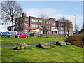
Quebec Barracks, Brighton
On Dyke Road.
Image: © Robin Webster
Taken: 13 Apr 2019
0.03 miles
3
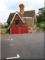
North Lodge, Old Mill Mews
One of two lodges built for the house, Highcroft, constructed in 1876. This lodge faced onto Highcroft Villas whilst South Lodge was based on Dyke Road. Highcroft still stands but is obscured from view by the Territorial Army depot. Taken from Old Mill Mews.
Image: © Simon Carey
Taken: 29 Aug 2007
0.03 miles
4
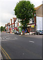
Shops, Dyke Road
Lining the eastern side of the road up the junction with Highcroft Villas and opposite a Tesco Express which just happens to be in the next grid square. The far building is the Dyke Tavern originally called the Windmill Inn after the mill that stood behind it.
Image: © Simon Carey
Taken: 29 Aug 2007
0.04 miles
5
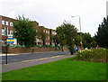
Territorial Army Centre, Dyke Road
Originally erected as a drill hall during the Second World War to replace older and inadequate ones in the centre of town. Part of its grounds includes Highcroft House whose two lodges are now separate homes.
Image: © Simon Carey
Taken: 29 Aug 2007
0.05 miles
6
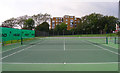
Tennis Court, Dyke Road Park
One of six in the northern section of the park near to Dyke Road itself. Park Lodge is in the background and next grid square.
Image: © Simon Carey
Taken: 29 Aug 2007
0.05 miles
7
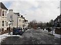
Highcroft Villas
The road links Dyke Road to Dyke Road Drive and was developed in the 1880s as an upmarket residential area.
Image: © Simon Carey
Taken: 12 Mar 2013
0.06 miles
8

The Dyke Tavern
Reopened in 2010 following refurbishment, details http://www.viewbrighton.co.uk/pubsandbars/dyke-pub-and-kitchen-info-62318.html
Image: © Paul Gillett
Taken: 31 Jan 2010
0.06 miles
9
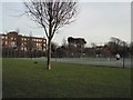
Tennis Courts in Dyke Road Park
The TA centre is in the background
Image: © Paul Gillett
Taken: 31 Jan 2010
0.08 miles
10

Booth Museum of Natural History
Constructed in 1874 to house the collection of stuffed birds owned by Victorian ornithologist Edward Booth. They are still there along with skeletons, fossils and a large butterfly collection. See http://www.booth.virtualmuseum.info/ for further information.
Image: © Simon Carey
Taken: 5 Nov 2006
0.08 miles