
IMAGES TAKEN NEAR TO
Reigate Road, BRIGHTON, BN1 5AJ
Introduction
This page details the photographs taken nearby to Reigate Road, BN1 5AJ by members of the Geograph project.
The Geograph project started in 2005 with the aim of publishing, organising and preserving representative images for every square kilometre of Great Britain, Ireland and the Isle of Man.

There are currently over 7.5m images from over14,400 individuals and you can help contribute to the project by visiting https://www.geograph.org.uk
Image Map
Images are licensed for reuse under creativecommons.org/licenses/by-sa/2.0
Notes
- Clicking on the map will re-center to the selected point.
- The higher the marker number, the further away the image location is from the centre of the postcode.
Image Listing (151 Images Found)
Images are licensed for reuse under creativecommons.org/licenses/by-sa/2.0
Image
Details
Distance
1
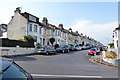
Compton Road, Brighton
Houses on the west side.
Image: © Robin Webster
Taken: 13 Apr 2019
0.03 miles
2
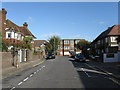
Wincombe Road
Small side street linking Dyke Road with Reigate Road that was developed between 1905-10. Hurst Court are the block of flats at the end of the road.
Image: © Simon Carey
Taken: 25 Oct 2009
0.05 miles
3
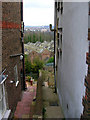
Derelict Railway Sheds
Located in the area between the junction of the main London-Brighton railway line and the Cliftonville Spur these sheds are now very dilapidated and no longer used. The view was taken from Millers Road and looks east between the gap of two sets of terraced housing and also gives an indication of the original scale of the excavation into the side of the chalk downs made by the railway. The green area beyond the sheds marks Preston Park.
Image: © Simon Carey
Taken: 11 Mar 2006
0.05 miles
4
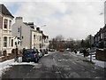
Highcroft Villas
The road links Dyke Road to Dyke Road Drive and was developed in the 1880s as an upmarket residential area.
Image: © Simon Carey
Taken: 12 Mar 2013
0.06 miles
5
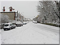
Millers Road
Steep climb up from Preston village to Dyke Road. A number of cars were having huge difficulty negotiating it this morning though why they tried in the first place is beyond me.
Image: © Simon Carey
Taken: 2 Feb 2009
0.06 miles
6
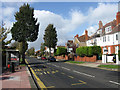
Bus Stop, Dyke Road
Near to the junction with Millers Road and The Upper Drive and served by the 27a Hangleton-Saltdean service and 77 summer service to the Devil's Dyke.
Image: © Simon Carey
Taken: 25 Oct 2009
0.07 miles
7
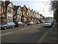
Millers Road
Suburban street near to Preston Park Station
Image: © Paul Gillett
Taken: 26 Mar 2011
0.07 miles
8
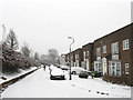
The Martlets
The eastern end of the road that begins at Merlin Close heads then swings round before continue back westwards towards Radinden Manor Road. This part runs parallel with Dyke Road which lies beyond the foliage to the left. The state was built in the 1960s on the site of a former school.
Image: © Simon Carey
Taken: 20 Jan 2013
0.08 miles
9
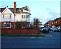
238 Dyke Road
Built in 1910 for Noah Clark then a director of Brighton & Hove Albion football club. A successful year for both Clark and the club as the latter won the Southern Championship that year then beat the Champions of the Football League, Aston Villa 1-0, to win the Charity Shield. The western gable on view has a plaster decoration of the Southern League Championship shield, the southern gable (out of view) has one of the Charity Shield itself. See Image for a close up view.
Image: © Simon Carey
Taken: 17 Mar 2007
0.08 miles
10
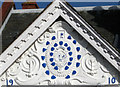
Gable, 238 Dyke Road
Closer view of Image showing the imprint of the Southern League shield won by Brighton & Hove Albion in 1910.
Image: © Simon Carey
Taken: 25 Oct 2009
0.08 miles