IMAGES TAKEN NEAR TO
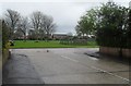
Boundstone Lane, LANCING, BN15 9QJ
Introduction
This page details the photographs taken nearby to Boundstone Lane, BN15 9QJ by members of the Geograph project.
The Geograph project started in 2005 with the aim of publishing, organising and preserving representative images for every square kilometre of Great Britain, Ireland and the Isle of Man.

There are currently over 7.5m images from over14,400 individuals and you can help contribute to the project by visiting https://www.geograph.org.uk
Image Map
Images are licensed for reuse under creativecommons.org/licenses/by-sa/2.0
Notes
- Clicking on the map will re-center to the selected point.
- The higher the marker number, the further away the image location is from the centre of the postcode.
Image Listing (122 Images Found)
Images are licensed for reuse under creativecommons.org/licenses/by-sa/2.0
Image
Details
Distance
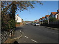
1
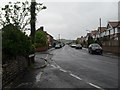
Approaching the junction of Boundstone Lane and Grafton Drive
Image: © Basher Eyre
Taken: 2 May 2010
0.02 miles
2
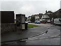
Phonebox on the corner of Boundstone Lane and Grafton Drive
Image: © Basher Eyre
Taken: 2 May 2010
0.03 miles
3
Looking towards the junction of Sompting and Leconfield Roads
Image: © Basher Eyre
Taken: 2 May 2010
0.03 miles
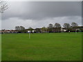
4
A wet and windy Sunday lunchtime in Croshaw Rec
Image: © Basher Eyre
Taken: 2 May 2010
0.04 miles
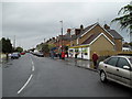
5
Boundstone Lane Lancing
The road runs north to join the A27 by the Sir Robert Woodard Academy, formerly Boundstone School.
Image: © Dave Spicer
Taken: 3 Dec 2012
0.05 miles
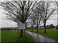
6
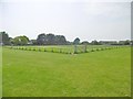
Sompting, recreation ground
Crowshaw Recreation Ground, on Cokeham Lane.
Image: © Mike Faherty
Taken: 18 May 2019
0.05 miles
8
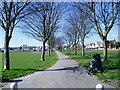
Lower Cokeham Recreation Ground
Looking west along the public footpath towards Cokeham Lane.
Image: © Peter Holmes
Taken: 4 Mar 2008
0.07 miles
9
Looking from Grafton Drive into Grafton Gardens
Image: © Basher Eyre
Taken: 2 May 2010
0.07 miles
10
Sunday morning football match on Croshaw Rec (3)
Image: © Basher Eyre
Taken: 2 May 2010
0.07 miles