IMAGES TAKEN NEAR TO
Rosecroft Close, LANCING, BN15 9HL
Introduction
This page details the photographs taken nearby to Rosecroft Close, BN15 9HL by members of the Geograph project.
The Geograph project started in 2005 with the aim of publishing, organising and preserving representative images for every square kilometre of Great Britain, Ireland and the Isle of Man.

There are currently over 7.5m images from over14,400 individuals and you can help contribute to the project by visiting https://www.geograph.org.uk
Image Map
Images are licensed for reuse under creativecommons.org/licenses/by-sa/2.0
Notes
- Clicking on the map will re-center to the selected point.
- The higher the marker number, the further away the image location is from the centre of the postcode.
Image Listing (132 Images Found)
Images are licensed for reuse under creativecommons.org/licenses/by-sa/2.0
Image
Details
Distance
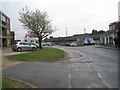
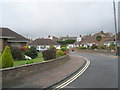
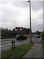
2
Looking from Station Approach into Rosecroft Close
Image: © Basher Eyre
Taken: 2 May 2010
0.03 miles
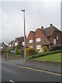
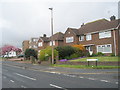
4
Looking down Rosecroft Close towards Station Approach
Image: © Basher Eyre
Taken: 2 May 2010
0.03 miles
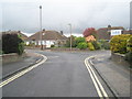
5
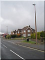
Approaching the junction of Station Approach and Rosecroft Close
Image: © Basher Eyre
Taken: 2 May 2010
0.04 miles
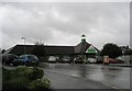
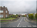
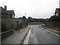
8
Looking from Rosecroft Close across the railway line towards Asda
Image: © Basher Eyre
Taken: 2 May 2010
0.05 miles