IMAGES TAKEN NEAR TO
Blenheim Road, LANCING, BN15 8UH

Introduction

This page details the photographs taken nearby to Blenheim Road, BN15 8UH by members of the Geograph project.

The Geograph project started in 2005 with the aim of publishing, organising and preserving representative images for every square kilometre of Great Britain, Ireland and the Isle of Man.

There are currently over 7.5m images from over14,400 individuals and you can help contribute to the project by visiting https://www.geograph.org.uk

Image Map


Images are licensed for reuse under creativecommons.org/licenses/by-sa/2.0
Notes
  • Clicking on the map will re-center to the selected point.
  • The higher the marker number, the further away the image location is from the centre of the postcode.

Image Listing (24 Images Found)

Images are licensed for reuse under creativecommons.org/licenses/by-sa/2.0
  • ...
Image
Details
Distance
1
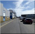
Blenheim Road, Lancing Business Park, Lancing
A cul de sac off Marlborough Road that was built in the mid 1960s when the former lancing carriage Works was converted into the Churchill Industrial Estate.
Image: © Simon Carey Taken: 31 Mar 2024
0.09 miles
2
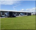
Paula Rosa Manhatten, Lancing Business Park, Lancing
The furniture manufacturer has occupied this site since 1965 (when it was known as Dennis & Robinson). The building was constructed in 1910 as the main part of a Carriage Works that had outgrown its original site adjacent to Brighton Station. The works were closed in 1962 and the land purchased by West Sussex County Council who turned it into the Churchill Industrial Estate which was renamed to Lancing Business Park around 2019.
Image: © Simon Carey Taken: 31 Mar 2024
0.12 miles
3
Paula Rosa Manhatten, Lancing Business Park, Lancing
A view of south along Blenheim Road. The furniture manufacturer has occupied this site since 1965 (when it was known as Dennis & Robinson). The building was constructed in 1910 as the main part of a Carriage Works that had outgrown its original site adjacent to Brighton Station. The works were closed in 1962 and the land purchased by West Sussex County Council who turned it into the Churchill Industrial Estate which was renamed to Lancing Business Park around 2019.
Image: © Simon Carey Taken: 31 Mar 2024
0.13 miles
4
The Quadrant, Marlborough Road, Lancing
Image: © PAUL FARMER Taken: 15 Nov 2022
0.13 miles
5
Chartwell Road, Lancing Business Park, Lancing
Originally known as the Churchill Industrial Estate it was opened in the mid 1960s on the site of the former Lancing Carriage Works.
Image: © Simon Carey Taken: 31 Mar 2024
0.14 miles
6
Twitten between Elm Grove and Chartwell Road
Image: © Shazz Taken: 11 Sep 2016
0.16 miles
7
Laburnum Close, Lancing
Image: © Stacey Harris Taken: 17 Dec 2011
0.17 miles
8
Open land with play area and seating by Elm Grove
Image: © Shazz Taken: 11 Sep 2016
0.19 miles
9
Winston Road, Lancing
Connecting Western Road to Marlborough Road and the main entrance to Lancing Business Park
Image: © Simon Carey Taken: 31 Mar 2024
0.19 miles
10
Cedar Close. Lancing
Image: © Stacey Harris Taken: 17 Dec 2011
0.19 miles
  • ...