IMAGES TAKEN NEAR TO
Penhill Road, LANCING, BN15 8HH
Introduction
This page details the photographs taken nearby to Penhill Road, BN15 8HH by members of the Geograph project.
The Geograph project started in 2005 with the aim of publishing, organising and preserving representative images for every square kilometre of Great Britain, Ireland and the Isle of Man.

There are currently over 7.5m images from over14,400 individuals and you can help contribute to the project by visiting https://www.geograph.org.uk
Image Map
Images are licensed for reuse under creativecommons.org/licenses/by-sa/2.0
Notes
- Clicking on the map will re-center to the selected point.
- The higher the marker number, the further away the image location is from the centre of the postcode.
Image Listing (99 Images Found)
Images are licensed for reuse under creativecommons.org/licenses/by-sa/2.0
Image
Details
Distance
2
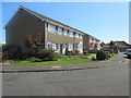
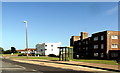
Cecil Road BN15 8HP
Typical bungalows for this area.
Image: © Peter Holmes
Taken: 18 Apr 2015
0.10 miles
3
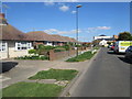
Housing near South Lancing, West Sussex
Seen from the top deck of a Brighton-Worthing bus on Brighton Road (A259), this housing is in Beachcroft Place.
Image: © Roger D Kidd
Taken: 1 Jan 2013
0.11 miles
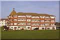
4

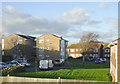
Beachville Court Brighton Road South Lancing
Image: © Dave Spicer
Taken: 3 Dec 2012
0.11 miles
5
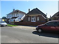
Lancing and Sompting Lions Community Hall
Roberts Road BN15 8AR.
Image: © Peter Holmes
Taken: 18 Apr 2015
0.12 miles
7
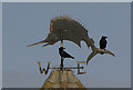
Marlin weather vane
Close up of weather vane on Marlin Court (see Image)
Image: © Ian Capper
Taken: 26 Dec 2007
0.14 miles
8
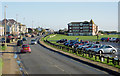
Brighton Road passing South Lancing, West Sussex
This is looking east along the A209 between Worthing and Shoreham-by-Sea and seen from the top deck of the Worthing to Brighton bus.
Image: © Roger D Kidd
Taken: 1 Jan 2013
0.14 miles
9
Marlin Court
A modern apartment building overlooking a green backing onto the beach. Note the weather vane on the turret at the left hand end of the building (see Image for close up).
Image: © Ian Capper
Taken: 26 Dec 2007
0.14 miles
10
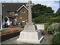
Lancing War Memorial
Between the Parish Hall and St Michael & All Angels Church
Image: © Josie Campbell
Taken: 2 Aug 2010
0.15 miles