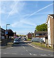
IMAGES TAKEN NEAR TO
Millfield, LANCING, BN15 0DW

Introduction

This page details the photographs taken nearby to Millfield, BN15 0DW by members of the Geograph project.

The Geograph project started in 2005 with the aim of publishing, organising and preserving representative images for every square kilometre of Great Britain, Ireland and the Isle of Man.

There are currently over 7.5m images from over14,400 individuals and you can help contribute to the project by visiting https://www.geograph.org.uk

Image Map


Images are licensed for reuse under creativecommons.org/licenses/by-sa/2.0
Notes
  • Clicking on the map will re-center to the selected point.
  • The higher the marker number, the further away the image location is from the centre of the postcode.

Image Listing (98 Images Found)

Images are licensed for reuse under creativecommons.org/licenses/by-sa/2.0
  • ...
Image
Details
Distance
1
Looking north along Millfield
Image: © Shazz Taken: 15 Nov 2015
0.01 miles
2
Millfield, Sompting
A cul de sac off Rectory Farm Road that was built as a council estate in the late 1920s with the flats added in the 1960s.
Image: © Simon Carey Taken: 12 Jul 2020
0.04 miles
3
Rectory Farm Road Industrial Estate, Sompting
According to Sompting's 1840 tithe map this was originally a field called Busticle Barn Field. By the First World War it had become a gravel pit and was the site of a German Prisoner of War camp. The pit was still marked on a 1948 OS map but had disappeared by the 1954 edition with the site being used as a Concrete Products Factory. The current industrial estate was built in the 1960s.
Image: © Simon Carey Taken: 12 Jul 2020
0.04 miles
4
Rectory Farm Road on a rainy Sunday morning
Image: © Basher Eyre Taken: 2 May 2010
0.04 miles
5
Approaching the junction of Rectory Farm Road and Millfield
Image: © Basher Eyre Taken: 2 May 2010
0.05 miles
6
Business premises to let in Rectory Farm Road
Image: © Basher Eyre Taken: 2 May 2010
0.05 miles
7
Approaching the junction of Rectory Farm Road and Busticle Lane
Image: © Basher Eyre Taken: 2 May 2010
0.05 miles
8
Approaching the junction of Bustice Lane and Rectory Farm Road
Image: © Basher Eyre Taken: 2 May 2010
0.05 miles
9
Parked cars in Rectory Farm Road
Image: © Basher Eyre Taken: 2 May 2010
0.05 miles
10
Junction of Rectory Farm Road and Busticle Lane
Image: © Shazz Taken: 15 Nov 2015
0.06 miles
  • ...