1
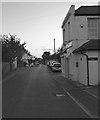
Marquis of Granby public house, Sompting
Image: © nick macneill
Taken: 8 Nov 2013
0.03 miles
2
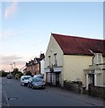
The Marquis, West Street, Sompting
The former Marquis of Granby is currently closed due to Covid 19 and given the condition of the exterior it looks like it will be permanent. The current building dates from the 1930s replacing an older public house of the same name that was first recorded in 1814. Church Lane is the road to the right.
Image: © Simon Carey
Taken: 22 Jul 2020
0.03 miles
3
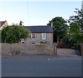
Direction Sign ? Signpost
Located on the south side of the junction of West Street and Church Lane in Sompting parish. 3 arms and annulus finial.
Milestone Society National ID: SX_TQ1605
Image: © Z La Gumina
Taken: 2 Aug 2020
0.05 miles
4
Alishaan Indian Restaurant, West Street, Sompting
Originally a public house called the Brewers Arms, then for many years a tearoom and restaurant known as The Smugglers. Currently serving Indian cuisine.
Image: © Simon Carey
Taken: 22 Jul 2020
0.07 miles
5
The Old Post Office, West Street, Sompting
The former village post office has long been closed and converted into a dwelling.
Image: © Simon Carey
Taken: 22 Jul 2020
0.07 miles
6
Brooklands, West Street, Sompting
Former farmhouse dating back to the late 18th century.
Image: © Simon Carey
Taken: 22 Jul 2020
0.07 miles
7
Hall, West Street, Sompting
Originally built in 1887 as a Methodist Chapel and later used by the Salvation Army. Not sure who uses it today.
Image: © Simon Carey
Taken: 22 Jul 2020
0.08 miles
8
Latimers Cottages/Edwards Terrace, West Street, Sompting
A row of nine terraced cottages built in the first decade of the 20th century. Latimers Cottages are the three to the left whilst Edwards Terrace are the remaining six to the right
Image: © Simon Carey
Taken: 22 Jul 2020
0.10 miles
9
A27, eastbound
Image: © N Chadwick
Taken: 30 Jun 2013
0.12 miles
10
Sign at the "Gardeners Arms" PH
Image: © Shazz
Taken: 26 Sep 2015
0.12 miles


