
IMAGES TAKEN NEAR TO
Lorne Road, BRIGHTON, BN1 4NL
Introduction
This page details the photographs taken nearby to Lorne Road, BN1 4NL by members of the Geograph project.
The Geograph project started in 2005 with the aim of publishing, organising and preserving representative images for every square kilometre of Great Britain, Ireland and the Isle of Man.

There are currently over 7.5m images from over14,400 individuals and you can help contribute to the project by visiting https://www.geograph.org.uk
Image Map
Images are licensed for reuse under creativecommons.org/licenses/by-sa/2.0
Notes
- Clicking on the map will re-center to the selected point.
- The higher the marker number, the further away the image location is from the centre of the postcode.
Image Listing (393 Images Found)
Images are licensed for reuse under creativecommons.org/licenses/by-sa/2.0
Image
Details
Distance

2

Stanley Road
Built in the 1850s for the lower middle classes on former download south of the newly built railway to Lewes. The road runs parallel with Viaduct Road (A270) towards Beaconsfield Road (A23). Today a mixture of family homes and student lets.
Image: © Simon Carey
Taken: 24 Mar 2007
0.03 miles
3

Clyde Road, Brighton
A residential street that originally ran from Vere Road to Beaconsfield Road though the latter has now been blocked and the road now performs a 'U' turn as it continues into Stanley Road. Developed, like much of the housing in the vicinity, in the late 1870s.
Image: © Simon Carey
Taken: 11 Oct 2015
0.04 miles
4

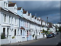
Lorne Road
Small street of terraced houses linking Stanley Road with Clyde Road.
Image: © Simon Carey
Taken: 24 Mar 2007
0.04 miles
6
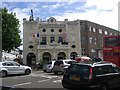
Duke of York's Cinema, Brighton
Photo taken in the week of the cinema's 100th anniversary. It has always been a single-screen cinema and has never been renamed!
Image: © Robert Rimell
Taken: 20 Sep 2010
0.05 miles
7
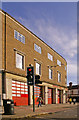
Preston Circus Fire Station, Brighton, East Sussex
Fire station at Preston Circus as seen from the A23.
Image: © Christine Matthews
Taken: 2 Nov 2008
0.05 miles
8
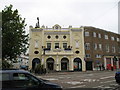
The Duke of York Cinema
Independent cinema at Preston Circus in Brighton
Image: © David Chappell
Taken: 6 Oct 2008
0.07 miles
9
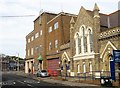
Calvary Church, Viaduct Road, Brighton
Built in 1876 as the Calvary Evangelical Church. It became the Railway Mission in 1895 when the former congregation moved to another larger church in nearby London Road. The mission evolved into the current church in the 1980s. To the left is Preston Circus Fire station.
Image: © Simon Carey
Taken: 25 Oct 2015
0.07 miles
10
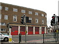
Fire Station at Preston Circus
Looking east across busy junction to the Fire Station
Image: © David Chappell
Taken: 6 Oct 2008
0.07 miles