
IMAGES TAKEN NEAR TO
Gloucester Passage, BRIGHTON, BN1 4AS
Introduction
This page details the photographs taken nearby to Gloucester Passage, BN1 4AS by members of the Geograph project.
The Geograph project started in 2005 with the aim of publishing, organising and preserving representative images for every square kilometre of Great Britain, Ireland and the Isle of Man.

There are currently over 7.5m images from over14,400 individuals and you can help contribute to the project by visiting https://www.geograph.org.uk
Image Map
Images are licensed for reuse under creativecommons.org/licenses/by-sa/2.0
Notes
- Clicking on the map will re-center to the selected point.
- The higher the marker number, the further away the image location is from the centre of the postcode.
Image Listing (1165 Images Found)
Images are licensed for reuse under creativecommons.org/licenses/by-sa/2.0
Image
Details
Distance
1

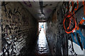
Gloucester Passage
Name of both the road and the path under the houses which link Gloucester road to Gloucester Street.
For a similar view taken in 1958 see http://regencysociety-jamesgray.com/volume25/source/jg_25_200.html
Image: © Simon Carey
Taken: 31 Jul 2011
0.00 miles
2

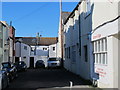
Gloucester Passage, Brighton
A cul de sac for vehicles though pedestrians can access neighbouring Gloucester Street through the passage on the left under the houses.
Image: © Simon Carey
Taken: 1 Nov 2015
0.01 miles
3

Gloucester Passage off Gloucester Street, Brighton
Image: © Ian S
Taken: 24 Jan 2016
0.01 miles
4
Gloucester Passage off Gloucester Street, Brighton
Image: © Ian S
Taken: 24 Jan 2016
0.01 miles
6

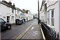
11, Gloucester Street, Brighton
The house straddles the entrance to Gloucester Passage, a relic from the 19th centuries where small passages were cut into rows of houses to allow access to more dwellings within. The vast majority of others in Brighton have now gone but this survives, see also https://regencysociety-jamesgray.com/volume25/source/jg_25_201.html ,a view from 1958 - the 'FP' plaque can be seen on that too.
Image: © Simon Carey
Taken: 30 Mar 2025
0.01 miles
8

Pelham Square
Head north up Gloucester Road, west a little way up Gloucester Street then north again along St Georges Place and west up Trafalgar Street then south into Pelham Square. The southern and western sides of the square were built in the 1840s whilst the eastern side behind the photographer was added in 1860. Unlike the aristocratic squares along the coast this one was built for the workers. The park to the left is well kept but a notorious hang out for drunks and homeless.
Click on the link to take you to the next page. http://www.geograph.org.uk/photo/231264
Image: © Simon Carey
Taken: 1 Sep 2006
0.01 miles
9

Brighton: Pelham Square
Named after Thomas Pelham, 1st Earl of Chichester, the square is tucked away on the south side of Trafalgar Street, and is surrounded on its west, south and east sides by 1840s and 1860s houses. Sadly, Simon's comments about its reputation in Image were proved true on the day the photograph was taken.
Image: © Nigel Cox
Taken: 8 Jun 2008
0.01 miles
10

Brighton: St George's Mews
This street runs between Trafalgar Street and Gloucester Street.
Image: © Nigel Cox
Taken: 8 Jun 2008
0.01 miles