IMAGES TAKEN NEAR TO
Broomfield Avenue, WORTHING, BN14 7SD
Introduction
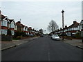
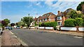
This page details the photographs taken nearby to Broomfield Avenue, BN14 7SD by members of the Geograph project.
The Geograph project started in 2005 with the aim of publishing, organising and preserving representative images for every square kilometre of Great Britain, Ireland and the Isle of Man.

There are currently over 7.5m images from over14,400 individuals and you can help contribute to the project by visiting https://www.geograph.org.uk
Image Map
Images are licensed for reuse under creativecommons.org/licenses/by-sa/2.0
Notes
- Clicking on the map will re-center to the selected point.
- The higher the marker number, the further away the image location is from the centre of the postcode.
Image Listing (69 Images Found)
Images are licensed for reuse under creativecommons.org/licenses/by-sa/2.0
Image
Details
Distance
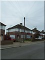
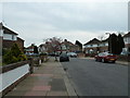
7
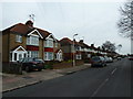
Lavington Road
Detached 1930's houses, with new attic rooms.
Image: © James Emmans
Taken: 4 Jun 2022
0.07 miles
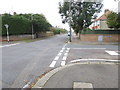
10
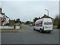
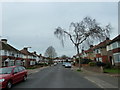
Junction of Broomfield Avenue and Loxwood Avenue
Image: © Basher Eyre
Taken: 2 Apr 2011
0.10 miles