IMAGES TAKEN NEAR TO
Gaisford Road, WORTHING, BN14 7HP
Introduction
This page details the photographs taken nearby to Gaisford Road, BN14 7HP by members of the Geograph project.
The Geograph project started in 2005 with the aim of publishing, organising and preserving representative images for every square kilometre of Great Britain, Ireland and the Isle of Man.

There are currently over 7.5m images from over14,400 individuals and you can help contribute to the project by visiting https://www.geograph.org.uk
Image Map
Images are licensed for reuse under creativecommons.org/licenses/by-sa/2.0
Notes
- Clicking on the map will re-center to the selected point.
- The higher the marker number, the further away the image location is from the centre of the postcode.
Image Listing (67 Images Found)
Images are licensed for reuse under creativecommons.org/licenses/by-sa/2.0
Image
Details
Distance
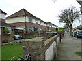
1
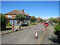
Gaisford Close, Worthing
Gaisford Close is a small development of housing in Worthing.
Image: © Malc McDonald
Taken: 2 Jul 2022
0.04 miles
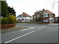
2
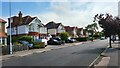
St Lawrence Avenue
1920's detached housing in an area called West Tarring.
Image: © James Emmans
Taken: 4 Jun 2022
0.11 miles
3
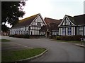
Worthing High School
Secondary school for students aged 12 to 16. Opened in 1914 as girls school, becoming grammar school in 1944, then Gaisford Girls' High School in 1973. Became comprehensive high school later.
Image: © WorthingMan
Taken: 15 Feb 2009
0.12 miles
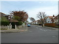
4
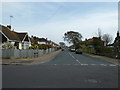
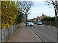
Looking from Nutbourne Road into Woodmancote Road
Image: © Basher Eyre
Taken: 2 Apr 2011
0.14 miles
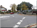
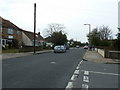
6
Junction of St Lawrence and Loxwood Avenues
Image: © Basher Eyre
Taken: 2 Apr 2011
0.15 miles
9
Junction of St Lawrence Avenue and Loxwood Avenue
Image: © Basher Eyre
Taken: 2 Apr 2011
0.15 miles
10
Looking from Nutbourne Road into Shermanbury Road
Image: © Basher Eyre
Taken: 2 Apr 2011
0.16 miles