IMAGES TAKEN NEAR TO
St. Lawrence Mews, WORTHING, BN14 7FD
Introduction
This page details the photographs taken nearby to St. Lawrence Mews, BN14 7FD by members of the Geograph project.
The Geograph project started in 2005 with the aim of publishing, organising and preserving representative images for every square kilometre of Great Britain, Ireland and the Isle of Man.

There are currently over 7.5m images from over14,400 individuals and you can help contribute to the project by visiting https://www.geograph.org.uk
Image Map
Images are licensed for reuse under creativecommons.org/licenses/by-sa/2.0
Notes
- Clicking on the map will re-center to the selected point.
- The higher the marker number, the further away the image location is from the centre of the postcode.
Image Listing (149 Images Found)
Images are licensed for reuse under creativecommons.org/licenses/by-sa/2.0
Image
Details
Distance
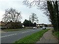
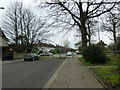
3
Looking eastwards in St Lawrence Avenue
Taken from South Street.
Image: © Basher Eyre
Taken: 2 Apr 2011
0.05 miles
5
Approaching a dead end in the western part of St Lawrence Avenue
Image: © Basher Eyre
Taken: 2 Apr 2011
0.06 miles
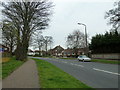
6
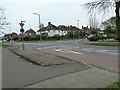
Approaching the junction of St Lawrence Avenue and Rectory Road
Image: © Basher Eyre
Taken: 2 Apr 2011
0.06 miles
7
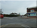
Looking across South Street towards Twitten Way
Image: © Basher Eyre
Taken: 2 Apr 2011
0.06 miles
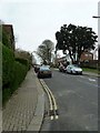
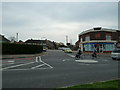
8
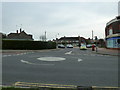
Mini-roundabout at the junction of South Street, Twitten Way and Rectory Road
Image: © Basher Eyre
Taken: 2 Apr 2011
0.06 miles
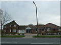
10
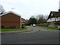
Looking from St Lawrence Avenue into Bishop's Close
Image: © Basher Eyre
Taken: 2 Apr 2011
0.07 miles