
IMAGES TAKEN NEAR TO
Brockley Close, WORTHING, BN14 7AW
Introduction
This page details the photographs taken nearby to Brockley Close, BN14 7AW by members of the Geograph project.
The Geograph project started in 2005 with the aim of publishing, organising and preserving representative images for every square kilometre of Great Britain, Ireland and the Isle of Man.

There are currently over 7.5m images from over14,400 individuals and you can help contribute to the project by visiting https://www.geograph.org.uk
Image Map
Images are licensed for reuse under creativecommons.org/licenses/by-sa/2.0
Notes
- Clicking on the map will re-center to the selected point.
- The higher the marker number, the further away the image location is from the centre of the postcode.
Image Listing (27 Images Found)
Images are licensed for reuse under creativecommons.org/licenses/by-sa/2.0
Image
Details
Distance
1
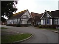
Worthing High School
Secondary school for students aged 12 to 16. Opened in 1914 as girls school, becoming grammar school in 1944, then Gaisford Girls' High School in 1973. Became comprehensive high school later.
Image: © WorthingMan
Taken: 15 Feb 2009
0.08 miles
3
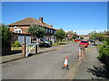
Gaisford Close, Worthing
Gaisford Close is a small development of housing in Worthing.
Image: © Malc McDonald
Taken: 2 Jul 2022
0.11 miles
4
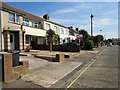
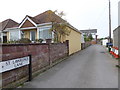
Centrecourt Road, BN14 7AG
Housing with car space.
Image: © Peter Holmes
Taken: 13 Sep 2016
0.13 miles
6
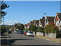
Balcombe Avenue, Worthing
Balcombe Avenue is a minor residential road in Worthing. This view looks northwards, towards the ridge of the South Downs.
Image: © Malc McDonald
Taken: 2 Jul 2022
0.18 miles
7

Brooksteed Alehouse, South Farm Road, BN14 7AE
Worthing's second micropub founded in September 2014. Awarded CAMRA Sussex Pub of the Year and CAMRA Arun & Adur Branch Pub of the Year for 2016.
Image: © Peter Holmes
Taken: 13 Sep 2016
0.18 miles
8
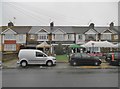
Worthing, Brooksteed Alehouse
Good Beer Guide-listed micro-pub on South Farm Road, closed at the time of the photo. A local produce fair is taking place.
Image: © Mike Faherty
Taken: 1 Dec 2018
0.18 miles
9
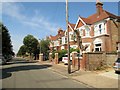
Pavilion Road, BN14 7EF
Row of large semi-detached houses.
Image: © Peter Holmes
Taken: 13 Sep 2016
0.19 miles
10
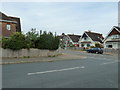
Looking from Adversane Road back into Balcombe Avenue
Image: © Basher Eyre
Taken: 2 Apr 2011
0.20 miles