1
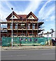
Worthing High School
Secondary school for students aged 12 to 16. Opened in 1914 as girls school, becoming grammar school in 1944, then Gaisford Girls' High School in 1973. Became comprehensive high school later.
Image: © WorthingMan
Taken: 15 Feb 2009
0.08 miles
2
Looking south on South Farm Road
Image: © Shazz
Taken: 1 Nov 2015
0.09 miles
3
Centrecourt Road, BN14 7AG
Housing with car space.
Image: © Peter Holmes
Taken: 13 Sep 2016
0.11 miles
4
Gaisford Close, Worthing
Gaisford Close is a small development of housing in Worthing.
Image: © Malc McDonald
Taken: 2 Jul 2022
0.15 miles
5
Looking north along St Lawrence Lane
Image: © Shazz
Taken: 1 Nov 2015
0.17 miles
6
The Southdown, Northcourt Road, Broadwater, Worthing
Opened in 1896 and closed in 2017 since when work appears to be ongoing to convert into flats.
Image: © Simon Carey
Taken: 31 Mar 2024
0.17 miles
7
Brooksteed Alehouse, South Farm Road, BN14 7AE
Worthing's second micropub founded in September 2014. Awarded CAMRA Sussex Pub of the Year and CAMRA Arun & Adur Branch Pub of the Year for 2016.
Image: © Peter Holmes
Taken: 13 Sep 2016
0.17 miles
8
Worthing, Brooksteed Alehouse
Good Beer Guide-listed micro-pub on South Farm Road, closed at the time of the photo. A local produce fair is taking place.
Image: © Mike Faherty
Taken: 1 Dec 2018
0.17 miles
9
King Street, Broadwater, Worthing
A residential street linking Queen Street to Northcourt Road that was developed in the 1880s.
Image: © Simon Carey
Taken: 31 Mar 2024
0.18 miles
10
Balcombe Avenue, Worthing
Balcombe Avenue is a minor residential road in Worthing. This view looks northwards, towards the ridge of the South Downs.
Image: © Malc McDonald
Taken: 2 Jul 2022
0.19 miles


