IMAGES TAKEN NEAR TO
Findon, WORTHING, BN14 0RL
Introduction
This page details the photographs taken nearby to BN14 0RL by members of the Geograph project.
The Geograph project started in 2005 with the aim of publishing, organising and preserving representative images for every square kilometre of Great Britain, Ireland and the Isle of Man.

There are currently over 7.5m images from over14,400 individuals and you can help contribute to the project by visiting https://www.geograph.org.uk
Image Map
Images are licensed for reuse under creativecommons.org/licenses/by-sa/2.0
Notes
- Clicking on the map will re-center to the selected point.
- The higher the marker number, the further away the image location is from the centre of the postcode.
Image Listing (36 Images Found)
Images are licensed for reuse under creativecommons.org/licenses/by-sa/2.0
Image
Details
Distance
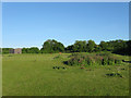
1
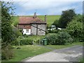
The Pest House
The current flint building dates from the early 19th century but given its isolation from the rest of Findon it was most likely built on the site of the parish pest house used to house those who had contagious diseases.
Image: © Simon Carey
Taken: 8 Jun 2013
0.01 miles
2
The Pest House at Findon seen across a field
See also an earlier submission http://www.geograph.org.uk/photo/442613 .
Image: © Shazz
Taken: 30 Jul 2010
0.02 miles
3
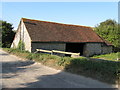
Pest House, Findon
The Pest House or a way of isolating those with infectious diseases, see more at http://www.findonvillage.com/0504_the_pest_house.htm
Image: © Peter Cox
Taken: 18 May 2007
0.03 miles
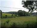
5
Pest House sheltering below Middle Brow
Image: © Dave Spicer
Taken: 19 Dec 2010
0.04 miles
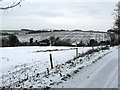
6
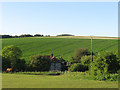
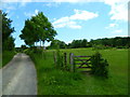
Route to North Farm
Bridleway 2086 crossing grazing land before joining track.
Image: © Peter Holmes
Taken: 21 Aug 2012
0.06 miles
7
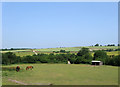
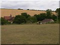
Lambhill (4)
The opposite view of Image The bridleway runs through the field to join up with the track, whose chalk covered surface is just visible at the end of the field. The track continues over the Downs to North Farm.
Image: © Simon Carey
Taken: 13 Jul 2013
0.06 miles
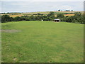
8
Lambhill (2)
The name of the field according to Findon's 1839 tithe map. This part lies to the south of the unnamed lane from North End to New Barn. See also Image and Image
Image: © Simon Carey
Taken: 8 Jun 2013
0.06 miles
9
Bridleway leaves track and enters field near Pest House
A view from the other direction is at http://www.geograph.org.uk/photo/1989813.
Image: © Shazz
Taken: 9 Jun 2012
0.08 miles
10
Pest House Field
The name of the field according to Findon's 1839 tithe map which lies to the east of Image with Image on the right.
Image: © Simon Carey
Taken: 13 Jul 2013
0.08 miles